
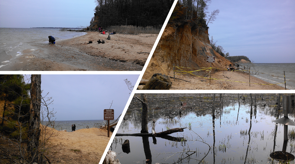
We read about Calvert Cliffs and possible shark teeth in the sand, so we decided to go for a day trip. There is an entrance fee per car. Based on the map, I believe we took the Red Trail (1.8 miles one-way) straight to the open beach, where you can look in the sand for fossils. It is illegal to be under the cliffs as it is dangerous due to possible landslides and risk of injury. We just rested before heading back as we weren’t interested in scavenging.
One of the more popular C&O visitor centers is the Great Falls Tavern, which is the entrance of the Great Falls overlooks. Billy Goat Trails, and miles of C&O trails. You can walk alongside the canal locks on the pebble/dirt path and enjoy the nature scenery. Many people run and bike as well, some bring their dogs and family out. This entrance does charge the park fee so make sure you have your annual pass or pay at booth.
We did go back in June ’17 to learn about the invasive snakeheads and tried to fish the canals for them. But we didn’t catch any, and the ranger gave us a couple pieces of meat to take home. It was white and meaty, pretty delicious!

The overlooks have some nice water views. We first checked it out back in ’07. All I remember it was hot and we weren’t into hiking just yet! We didn’t know about Billy Goat till later when we started researching what unique hikes are out there. Please excuse the poor photo quality 🙂
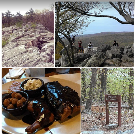
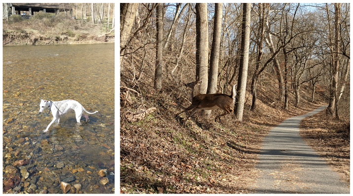
There are 3 sections to the Billy Goat trail off the C&O canal. The most popular and fun trail A is hands-down. We explored B and C back in 2017 but it was nothing special (typically they are closed every time I checked on Billy Goat A’s status). Since we have an annual pass, we park within the C&O NPS lot but there is an entrance fee of $20 now. You can also park for free at the Great Falls dirt parking lot across from Angler’s Inn if you go there early enough. It is also possible that the trails may close if rain fell recently, so always check the NPS website for the current conditions.
Trail A (no dogs allowed)
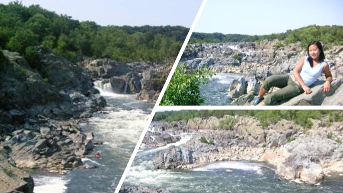
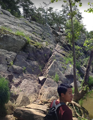
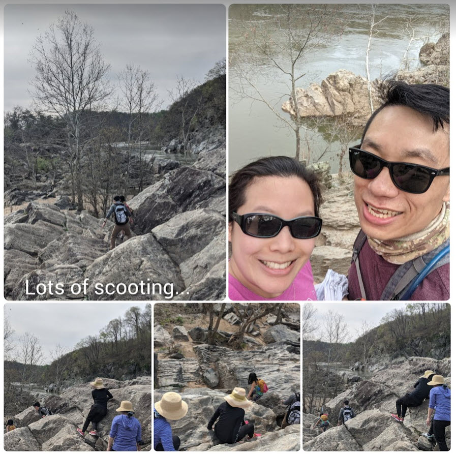
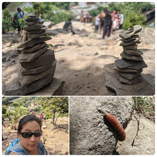
We explored it first by ourselves back in July 2013 after reading about it on the internet. Either from the Great Falls visitor center or the parking lot, it’s about the same length to get to the trail and back to the car. It seems like a long walk to just get to the trailhead, which starts right by the Stop Gate. As of 2020, It is recommended one-way trail, as you will need to go up a traverse part of the rocks. It was our first rock scramble experience, and it was a lot of fun! Total hike was about 3 miles, 2-3hrs.
We took our friends a week later and they all enjoyed it, although it was a very hot day. You definitely want to bring water and snacks for your hike! Plenty of views and places to rest throughout!
We later took our families back in Nov 2020 and 2021. The kids enjoyed it as it’s a fun hike to get interested and to start exploring other trails in the area. We missed the Traverse completely in 2020, as maybe there was a detour. 
Fall/winter hiking is actually great weather, even though it starts off cold in the mornings but after you scramble and hike through the 1.7 miles trail, you’re steaming. The walk back to the car was uneventful and we always grab food in the area afterwards (we typically burn about 1k calories!)

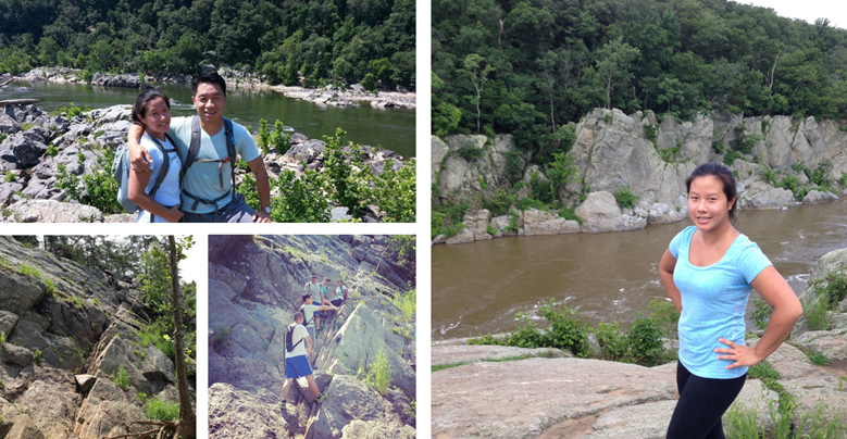
It was our first hike in the year 2022 as we went on a nice April weekend with old and new family members who haven’t been on this trail. It feels so good to go out and hike, then eat all the calories back afterwards!
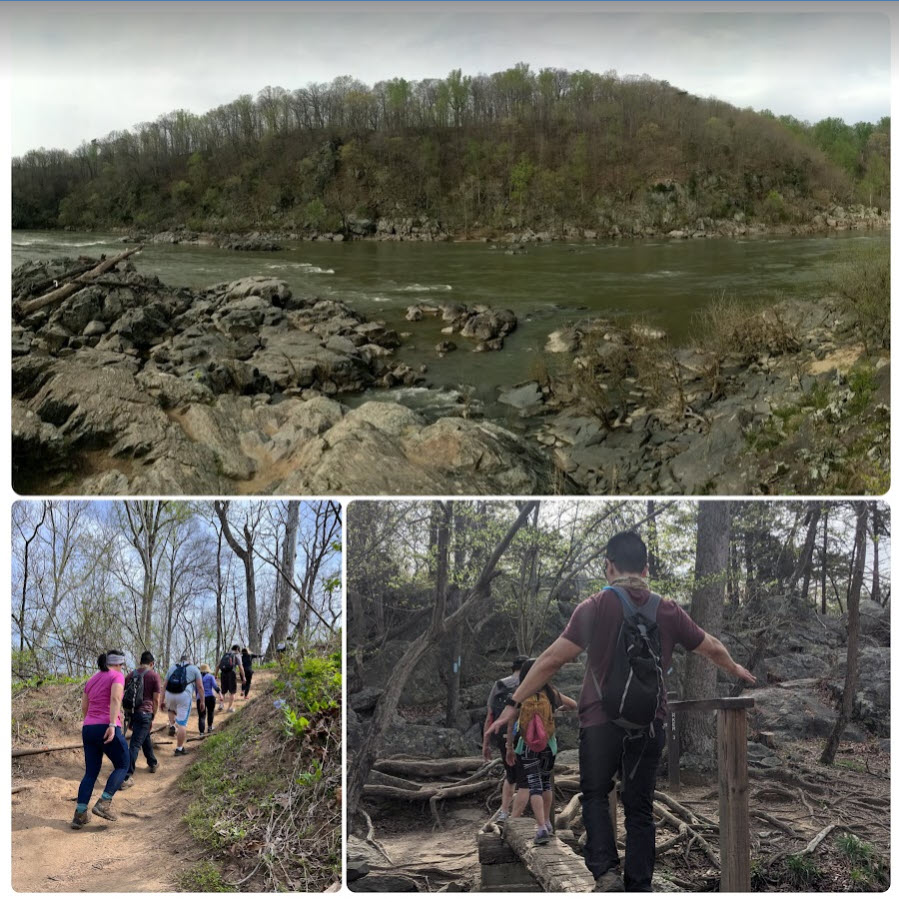
Easter 2023 – we wanted to do a casual walk at Patapsco state park but the main walk is under construction. We decided to hike Billy Goat trail instead and got our annual park pass for the year, since the free parking lot was full by 11a. We started the trail by the Tavern VC and picked up my stamps as well.
It wasn’t busy at all. We barely rested during the whole hike since there were swarms of flying insects so you couldn’t sit anywhere on the rocks without them flying into you. We also didn’t have enough water or snacks since we originally through we were just going to hike locally.
We stopped by the overlook via boardwalk. Too many people so we quickly left. I started to developed a severe headache and so we went to Leid poke for lunch, thinking food and water would help. But of course, I also needed Advil and rest. The drive home was terrible around Tyson area as always.

Summer 2023: We paid Billy Goat another visit with coworkers, it was fun to catch up and actually have time to rest in the middle to take in the view. We tried another poke place (Poke Dojo) with a groupon (half the price) in Bethesda. It was still ridiculously expensive and I didn’t enjoy the Keto Bowl (zucchini noodles, there was too much sauce so it felt salty to me). I tried a Jeni’s ice cream (2 scoops) down the street afterwards, the dark chocolate was delicious but not a fan of the lavender flavor though!
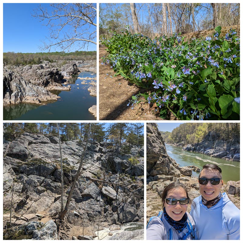
Spring 2025: Unfortunately, it took us 2 years to pay Billy Goat A another visit on a nice cool spring day. There’s always a bottleneck of people around the scrambling and traverse area but there was plenty of places to rest and enjoy the scenery. We saw some kayakers in the water, and folks on the VA side hiking the Great Falls trail.
Trails B & C
We decided to explore B & C after doing A in 2013, and I can’t tell you how it went as it was uneventful, and the views were just not as nice. Trails B and C are about 1.4 miles and 1.6 miles long, respectively. These trails are further south so plan accordingly where to park.
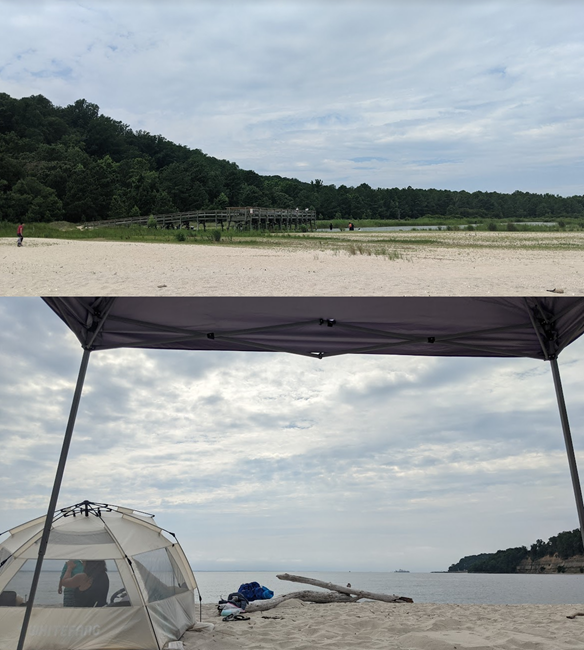
This is the first time at Flags Pond Nature Park with our friends and their kids for a day trip at the beach. There was a small entrance fee ($8 cash) for out of county residents and limited parking lots. Go early and bring a backpack/cart since it’s about a mile walk to the beach/water. There are bathrooms by the parking lot and off the trail (beach access).
Even though it started off cloudy, the sun came out after lunch and we were glad to have canopy tents to sit under. We brought subway for a quick lunch but our friends made some Korean BBQ meats on a portable grille – hard work but delicious lettuce wraps on the beach. My friend also found a couple shark teeth by sifting through the sand but that was too much work. We saw a fisherman get a few fish, but most of the time, lots of kids in the water and dogs with families. The walk back to the parking lot was a little tough since it’s uphill and warmer than earlier.
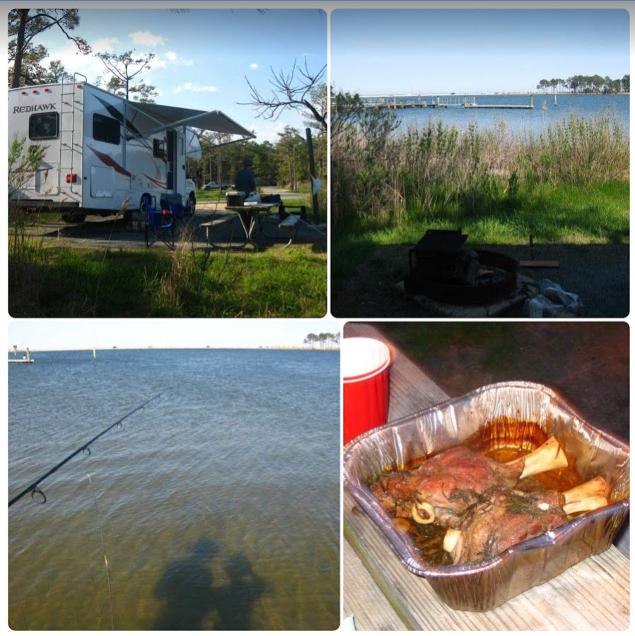
We had rented houses near Point Lookout State Park and decided to take our friend’s RV and camp in April 2014. But, we used the state park’s facility for the bathroom/showers. We prepped food (e.g. taco lunch in a Doritos bag) and cooked on the fire (lamb leg for dinner and eggs for breakfast). During the day, we walked around the trails, saw some lodging and checked out the water nearby.
We even ventured to the pier for night fishing but it was just too dark and rainy to really catch anything. Overall, it was a fun time but it’s hard work to plan and prepare a trip as you need to bring a good amount of things you normally would have available in a rental house.
Savage Mill has some trails and shops to check out. The trail by the river is overrun by bushes so I didn’t enjoy this hike very much. Folks can fish by the river by again, it’s swallow and you will get snagged in the rocks!
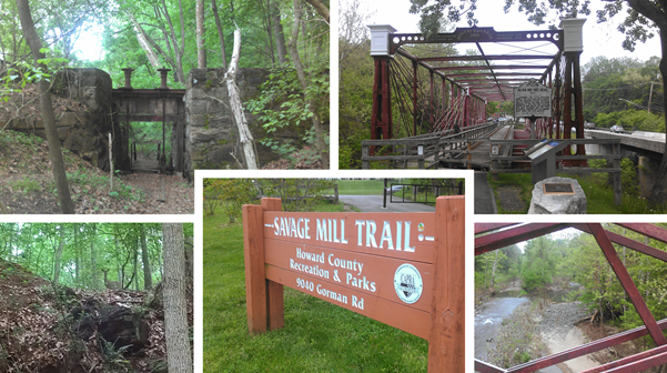
I never checked out the shops but they did have shows at the Ramshead Tavern. It looks like they closed during pandemic and Dive Bar & Grille took over their location.
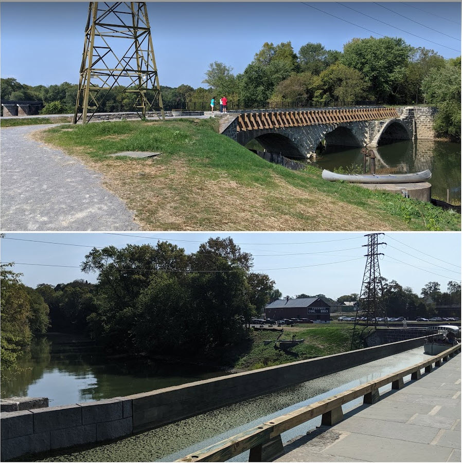
We decided to visit and take a free boat ride/tour on the Conococheague Aqueduct in fall 2019 (they had just completed restoring it in over 2 yrs), see more info about the Williamsport Visitor Center. We started at the Cushwa Warehouse where the ranger loaded us on the boat and then slowly took us across the water and down the aqueduct. We turned around at the end and back to land. It was very unique as you don’t see many aqueducts with water anymore.

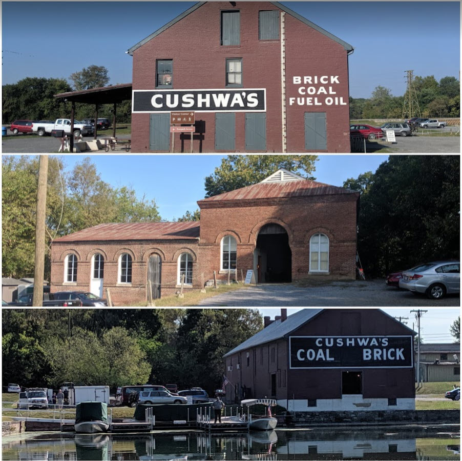
After the tour (maybe 30-45 mins), we borrowed some rental bikes at the back of the visitor center to bike along the C&O towpath. We had to take it over the historic railroad lift bridge using the bike ramps and stairs. It was a little uncomfortable on the bike as they were super old and I’ve short legs. We didn’t go too far before returning it after checking out some spots on the towpath, but it was much faster than “walking” if you want to explore the towpath.
There is a popular Paw Paw tunnel they mentioned during our visit. believe they also just restored this back in 2017 and it’s a 2.4 mile long trail (out-and-back). I did a bit more research, they created a detour so still some constructions. I will most likely group this trail on the way to Zumbrun Overlook and stay a night by Blackwater Falls State Park (WV) in the near future.
Catoctin Mountains Park
I don’t recall a fee at this location and just checked the NPS site, it’s FREE! We hiked the East Side Trails up from the Visitor Center to Wolf Rock and then Chimney Rock via the orange blaze (3.9 mile loop). We spent half a day exploring the area and rushed down toward the end when it started to drizzle. We did have a nice hot meal at a BBQ restaurant off 70 on the way home.
Cunningham Falls
This is the highest cascading waterfalls in Maryland, at 78-ft tall! We went by ourselves first in fall 2012 then took our friends to visit later in fall 2013. It was an easy trail/boardwalk to see the falls (yellow blaze, east side trails). If you dare, you can venture and scramble around the falls.

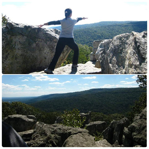
We didn’t have hiking boots yet as this was one of our first taste of hiking. We had a snack up there and continued on the yellow trail to Hog Rock and then the Blue Ridge Summit Vista. I believe we also checked out Thurmont Visit before returning to the visitor center and did other east side trails. But I always like to do a quick warrior pose at high points!
Sugarloaf Mountains
We explored this location when we did a few hikes while staying a night or two in Frederick, exploring Harper’s Ferry and Catoctin Mountains Park. Although we only drove up to the top and walked up a few steps to see the views. Here’s the trail info as the main website doesn’t look official.
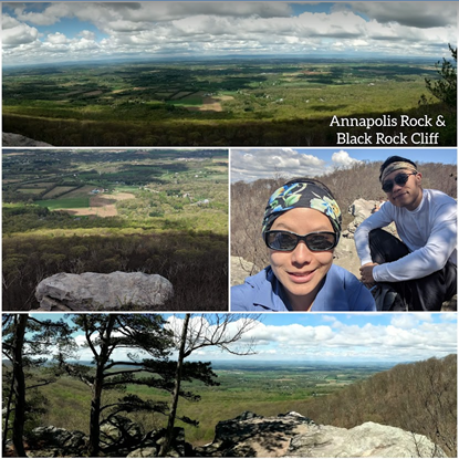
Annapolis Rock and Black Rock Cliff
This was my first time here, but he had already hiked this trail with the guys on another day before they went camping. I’m not one to camp outdoors so it’s usually a guys trip but they haven’t gone in a few years now. The parking lot is easy to find, but may be limited on nice weekends. It’s quite noisy starting off near 70, the car whooshing by as you cross a pedestrian bridge and parallel to the highway. I couldn’t wait to get into the woods as quickly as possible.
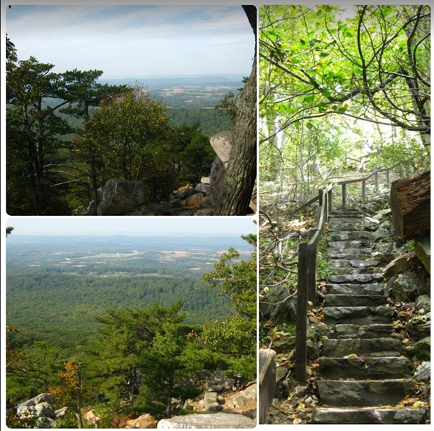
I don’t recall it being 8 miles, but the trail was a steady incline, nothing too strenuous but I suppose it took us about half day to visit both lookouts. Annapolis Rock, where you can see a view of the Greenbrier Lake, and look through/write in a composition book since the Appalachian Trail goes right through this trail. The Black Rock Cliff gives you another view of the west before returning back to the parking lot.
High Rock and Raven Rock
Another trail we haven’t gone on, but it’s via the Appalachian Trail too! You can hike it (6 miles!) or drive right up to High Rock to view the graffiti artwork. Based on others comments, we may just drive by to see the artwork and tackle the other trails at Catoctin Mountains if we head that way.
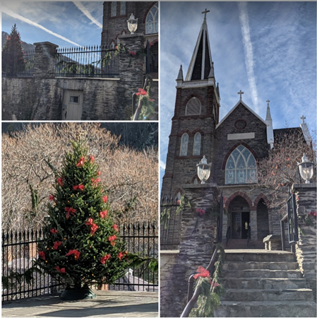
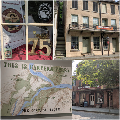
I remember visiting this place as a kid as vague memories of the Maryland Heights trail (all I remember it was very steep and I slept good that night!). I was just tagging along with people and I guess I made it! to the top I would recommend checking out the NPS site, as parking is off-site with shuttle running fairly frequently if you want to check out the Harpers Ferry town. There’s some shops but really not much else to explore in my opinion. I specifically talk about the Maryland Heights trail, Loudon Heights trail, and whitewater rafting experience below.
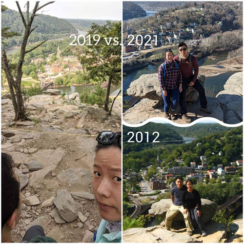
Maryland Heights (2012, 2019, 2021, 2022, 2024, 2025…)
There were limited parking spots on side of the road by the Maryland Heights trailhead but there’s barricades now. From the official NPS parking lot, there’s plenty of spots and take the shuttle into town then walk across the bridge to the trailhead (that trail is about 4.6 miles total). The trail itself to the overlook isn’t long, but it is a steady steep incline and gets rocky toward the cliffs. Poles and snacks are much appreciated!
We’ve visited one more time in June 2025 during the annual peregrine falcon nesting season where they rope off sections at the overlook between mid Feb to July. Always check the NPS page for alerts! There was still plenty of places to rest and take pictures. We noted it has become so popular over the years.
I took my friend up in Oct 2024 and it was the perfect fall weather (sunny, but cool). Typically, it takes 1.5-2 hrs for the hike and you can grab food downtown. The town was so busy around lunchtime, we didn’t want to wait 30m for Rabbit Hole. We decided to walk up the hill another 15minutes for some delicious carbs at the Bolivar Bread Bakery. They were celebrating their 3yr year anniversary with raffles! I also noticed there are some parking spots nearby if you don’t have a pass and want to walk down the hill into town.
We went in Aug 2022 with our family (their first time) and they really enjoyed it. It is always a workout going up but with plenty of rest and snacks, we took pictures and then headed down. We saw a plump looking grub/caterpillar making his way up the rocks. We also saw folks floating down the river in tubes. What an amazing day!

In Dec 2021, it started off cloudy and cold (40s) as we parked at the visitor center. Instead of taking the shuttle that morning, we walked 1.8 miles using the Lower Trail from the parking lot to the lower town. Right under the bridge/road, there is a small parking lot but you have to pay the same entrance fee and it fills up quickly. So if you got the pass, just park in the visitor center up the street and hop on the shuttle (wear your masks). In town, I stopped by the bookstore to grab 8 stamps since Appalachian Trail goes trough the town, there’s extra stamps associated to different trails.
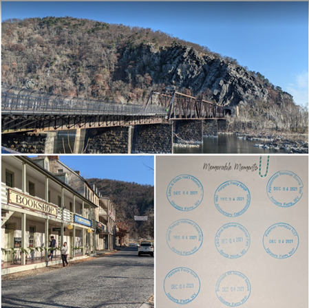
Make sure you use the bathroom in town before you start your 1-mile hike across the bridge and along the dried up canal of C&O to the Maryland Heights trailhead. The bridge is right next to an active cargo railroad track. When several train cars derailed off a portion of it (Dec 2019), it was closed for the first half of 2020 and reopened by July.
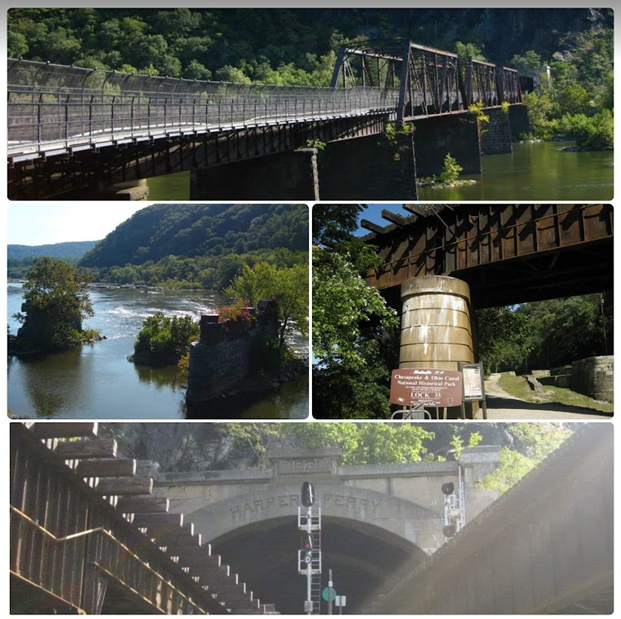
On the bridge you will notice many locks all over the fences and some that were daring climbed near the top of the fence to get their lock on the structure itself! I just focused on looking ahead and not down in the waters as I get a little fearful crossing bridges. Mainly because I’m afraid I’ll drop my phone and also I don’t like heights!

It’s a short walk down the gravel C&O trail and then we crossed a small bridge and road to the trailhead. It is about 2.8 miles total (2-hr) to the overlook (red blazed). We took out our pokes and started on a steady incline up the blue blazed trail. There is a small loop where if you continue on the right, it takes you by the naval battery field, but if you don’t care for that, you can just take the first blue trail marking on the left (it is a much easier trail) since there’s not much to see at the field.
You will encounter another intersection of the green blazed trails and a large sign, we rested nearby. We continued up, switchbacks and down the red blaze to the overlook. There were several groups of people at the overlook so we picked a rock to rest and have our sandwiches. The group of boy scouts left and we made our way to the rock for our picture comparison.
The Amtrak train comes pretty frequently, we kept hearing the toot of it during our hike. The sun has come out so it got pretty warm as we made our way back down the mountain. If you want to read about the green trails, keep scrolling!
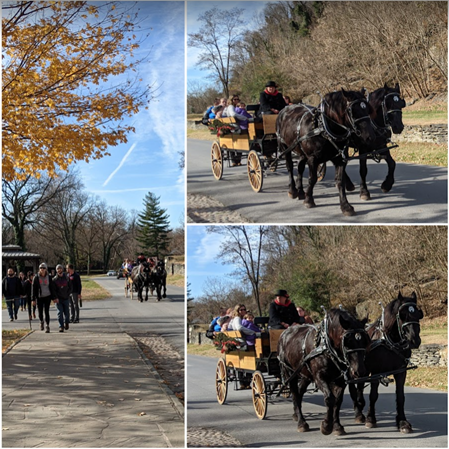
That weekend also featured the 50th anniversary “Olde Tyme Christmas” events with live music, festive activities, horse drawn wagon, holiday light tour, etc. It was more crowded than our other two visits but it was nicely decorated and very festive.
We caught the shuttle back up to the parking lot as I could feel my feet getting fatigued after ~6.75 miles total that morning. We didn’t have time to visit the Weverton Cliffs in the area so we hope to come back sooner than later!
Previously we went in June 2019, we parked right by the trailhead and it was a good cardio hike. Apparently these summer months are when they typically rope off portions when the birds nest on the overlook cliffs.

Prior in Sept 2012, we did the whole hike from the town, bridge, overlook, then up to the 100- and 300-pound battery sites (green blazed). Just a caution that the green trails were not well-traveled as the grass were overgrown and deer were popping out in front of us. Not much of a view here so we only done this once and website says it was about 6.6 miles total. I didn’t have an activity tracker back then so not sure how much we did.

Loudoun Heights (2015)
Since visiting the Maryland Heights in 2012, we decided to check out the other trail on the other side. We took the day off to get a hike in before meeting our friends for the weekend rental house to do whitewater rafting. We parked on the side of another bridge (small fee, limited parking so you have to go early) and crossed the noisy bridge to work our way up to Loudon Heights. I don’t recall it being 7 miles long and the views aren’t as nice as the Maryland Heights. Even the Split Rock at the end of the “trail” wasn’t memorable to me. But, check it out if you’re staying in the area. We still enjoy the Maryland Heights trail the best!

Whitewater Rafting (Aug 2015)
The rental house was literally down the street from the River Riders resort. We walked up to purchase our ticket, watched a safety video and made sure we had our water shoes on. We just bought a few cheap pairs from Walmart. We stored our belongings we don’t want getting water into lockers and made our way to the river side with our guide. I can’t recall her name but I know she loved to entertain us with animal noises and did her best to ensure we had a “rapid” good time.
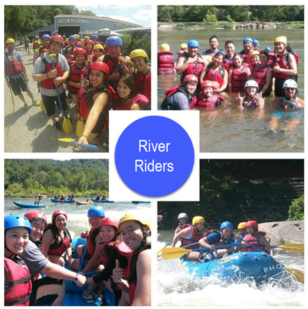
It was actually a calm and low water day (there are classifications of rapids), so I would say it was a Class I-II out of VI. We did a few demonstration of popping the raft into a lil rapid pool so we could experience the rapids power. Otherwise, we kept our positions on the raft, with one feet tucked under the raft side so we were always anchored. That leg started to ache being in that position for a few minutes and also soaking wet/cold. But, luckily, we didn’t fall overboard but our other friends’ raft were not so fortunate. We cruised down the water and met a few other people just floating down in their tubes and connected cooler. That looks like a fun time! We made our way to the shore to rest and we got picked up in a school bus by the side of the road to take us back to the resort.
We aren’t water people so we most likely won’t go back to do water activities unless a friend wanted to arrange something. But Harper’s Ferry is very popular in the summer time!
As I write this section, I realized there is only one MD ski resort at Deep Creek, Wisp. All the other ones we have been to are mostly in PA and I guess we went to one in VA. I won’t write about these experiences in PA or VA pages since it is a small section and I don’t really remember which year and which resorts we went to.
Instead, I’ll just write about my overall experiences with learning how to ski when I was young with my family. I took a class or two before practicing on the bunny slopes. Fast forward to college years, I went with friends on college nights where you get a discount if you show your college ID for admission and rentals. This is when I tried snowboarding for the first time. I did it a few times and got stuck on the black diamond trail for a bit (my bum was frozen from sitting on the ground and trying to call anyone who would pick up their phones). I think the motion of sliding sideways down the mountain on snowboards was scarier than siding face forward on skis. I did eventually get help from a friend who stumbled upon me and showed me how to snowboard face forward so that was enjoyable but I think that was the last time we went (circa 2012).

We had rented a few cabins/lodges by ski resorts with our friends during the winter time (2008-2014), but we don’t always go snowboarding with our friends anymore. We just stay in the house and play with the fireplace. Although it’s been a few years now since we went for our friend’s bday around MLK weekend, as we have been going to Texas instead (that page will be coming soon too)!

We heard of this place when we were staying at this large rental house in Deep Creek for an engagement party. We set up the event, dressed up to take pictures, had a buffet-style dinner and celebrated all night (e.g. watched The Walking Dead in the theater room, played in the rec room, and splashed around in the indoor pool/hot tub).
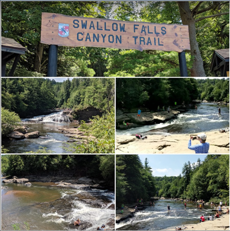
Finally, we decided to finally check it out on the way back home from our PA trip (more on PA – check out my page). The website advertises a 53-ft waterfall (Muddy Creek Falls – highest free-falling in MD!!), no fee, but there is limited parking as it gets very popular during the weekends, especially in the summer.

The trails were packed and we did not wish to dip in the waters. There were dogs and kids everywhere. We couldn’t wait to get through the trail and go home.

We finally tackled this short hike one fall weekend. There’s a small park and ride down the street from the trailhead, but you need to go early for a parking spot.
It’s only a mile up a steady, switchback path up to the cliffs. You can continue north on the Appalachian Trail but we didn’t plan to that morning.
From the cliffs, the almost bare trees still obscure the river view. I didn’t go further down the rocks to get a better view. There were a few people lounging in the trees so we gave them their space.
We enjoyed a lil break with snacks and felt the sunshine at the top before heading back to the car. We noticed a bunch of little bugs flying around by the parking lot so be quick getting into the car.
Overall, I probably wouldn’t go back but it is a good free short hike just to get out. But I would still go to Maryland Heights at Harper’s Ferry any day, even it cost and takes longer, but the view is much rewarding!
This National Monument/Historic Shrine is located right outside of Baltimore downtown. It’s easy to get to from 95 and plenty of people go there to walk around. There is a fee, so you must show your park pass or pay the fee to go through the visitor center doors to explore the rest of the grounds.
I took my cousin once when he visited us internationally. It was a nice sunny day that fall of 2017, we had just walked around the Inner Harbor (e.g., the usual shops, Baltimore Aquarium, and the MD Science Museum right by the harbor) and decided to check out this NPS location. We walked through the exhibits, fort and grounds.

After a yoga class in Fed Hill, I went again to purchase a new annual pass in 2021 since I didn’t want to pay the extra fee if you purchased your pass online. FYI: they do not give out car hang tags at this site, where you can hang your card on the rearview mirror. I didn’t pack my shoes so I didn’t walk around for steps that day.
We drove past Gunpowder Falls State Park many times going up to NY and decided to make a trip. I studied the different locations and picked a few trails by the Jerusalem Mill. It is also the park’s headquarters and visitor center.
In spring 2019, we parked by the headquarter and started onto the Little Gunpowder Trail. There were 2 stream crossings along the way. I was unsuccessful in the 2nd one where I fell and got my bum wet. I promptly turned around because if I crossed over, I would have to cross back! That trail was uneventful and muddy as well. Whenever there are any possible stream descriptions when I do my research, I would most likely cross it off my list. Even though my boots are “waterproof” to a degree, I still don’t want to waddle through water if I can help it!
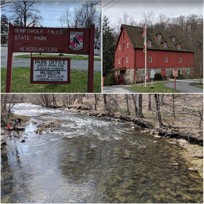
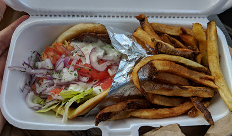
We walked back to the mill and toured it since it opened. We then watched some people in the river fishing and started on the blue trail (Jerusalem Mill) that took us through the woods. Then we walked through a bright red covered bridge and back through the village. We had a nice hot gyro lunch up in White Marsh afterwards!

Avalon/Orange Grove/Glen Artney/Hilton Areas
We frequent these areas over the years, easy to explore a trail each time and it’s right off the main highways. Here’s the website link in case the map updated since Dec 2019.
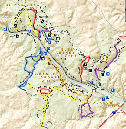
A lot of cars used to park on Ilchester Road and never seen enforcement. I’m not sure anymore as they were cracking down on illegal parking. After an annoying event where the towing truck was waiting for us to return to the car, they charged us $ to unload off the tow truck versus to pick it up at the towing lot. I guess COVID put a strain on companies so they started to enforce towing when folks got fed up with being quarantined and wanted to get out (fall 2020). During that time, we only walked the whole length of the gray trail (Grist Mill) from Hilton to Avalon and back (~3 miles one way).

I would highly recommend you pay the small fee and park within the park (entrance is off route 1). This trip started along the Grist Mill Trail from Avalon area, crossed the swinging bridge up to Cascade Trail. And a bonus, it’s right down the street from Guinness brewery if you want a nice cold beer after a hike!

1. Hilton Area
There are other places to park north of Ilchester Rd if you want to explore this area without having to park in Avalon area. The Buzzards Rock is a nice trail where you can overlook the valley. It is a bit steep descending to meet the Grist Mill Trail, which is a long, mostly paved and wide sidewalk (5 mile total). Cyclists and runners often pass us and then we pass dogs/family that frequent this path. The Saw Mill trail is a bit more muddy from my recollection. I don’t think we did the Santee trail that connects into Glen Artney.
I also wanted to mention that the Bloede Dam at the end of this area was removed by 2019 and it took them about 2 years to complete. Also, when a large storm hits the area, trees would be seen fallen through the park. It amazes me how powerful Mother Nature is.
2. Avalon
Avalon is the entrance to the park ($2-3/car), there are many picnic spots and parking areas to visit. You can even rent a few pavilion near SoapStone Trail as we discovered it when we biked through the area. Since it was still cold out, no one was picnicking so we went up the loop counterclockwise, which was had steep inclines and rode the way down (I was mostly on the brakes) but it was fun!

3. Orange Grove
We have crossed many times across the swinging bridge from Grist Mill to Cascade Falls via Cascade Trail. You encounter the babbling Cascade Falls, cross several small creeks and can continue through the woods via Morning Choice Trail to Old Track Loop and then back down Ridge Trail to the parking lot. We’ve also biked along the road but there’s not really a path for hikers so you should follow the trails in the woods.
These trails are uneventful for the hikes, but very popular for the mountain cyclist enthusiasts. So you need to be on the lookout constantly for cyclists flying toward you! I don’t find this very enjoyable and I’m sure they don’t find hikers on the trail enjoyable to avoid running over.
We’ve parked on Landing Road once and explored Morning Choice Trail and Rockburn area a few years ago. I recall seeing some old structures in the woods, nearing private properties, and crossing a big stream (took my shoes off). I did not enjoy that part so I will never return to that portion of the park.
We visited this area once a few years ago, right around the time we started to hike so I didn’t document as much. I recall a flat gravel road to the dams and back. Maybe we saw some folks fishing in the river. It looks like there’s just one trail called the Main Line that takes you upstream.
We have not visited this area and most likely will not in the near future. It looks fairly popular for picnics and only has a few short trails.
We visited this area once in Spring 2019, the leaves were out yet and it was still chilly that morning. It’s an honor system to pay if you get there before the rangers. We hiked about 4 miles, starting off on the purple trail (Tall Poplar) toward the red trail (Plantation) which you are descending toward the river. Then we followed the trail along the river to the yellow/orange trail (McKeldin Rapids). I don’t recall which trail we returned to our car but the sun finally came out at the end of our hike. It was nice to explore another part of Patapsco Park, but probably won’t be back.
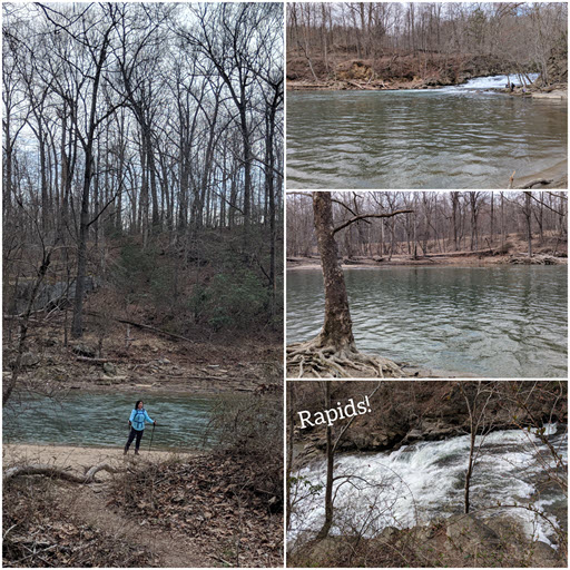

FYI: there is plenty of parking and bathrooms throughout the park. We also noticed cars parking outside of the park, off Marriottsville Rd so you can hike in without having to pay the fee.
Our friend mentioned wanting to check Rocks State Park and off we go (fall 2014). We visited the Kilgore Falls first then made our way up to the King and Queen Seat. Kilgore Falls is the 2nd largest free-falling waterfalls in MD (1st being Muddy Creek Falls in Swallows Falls – check it out in my Western section), we did scramble up to the top and explored the area.
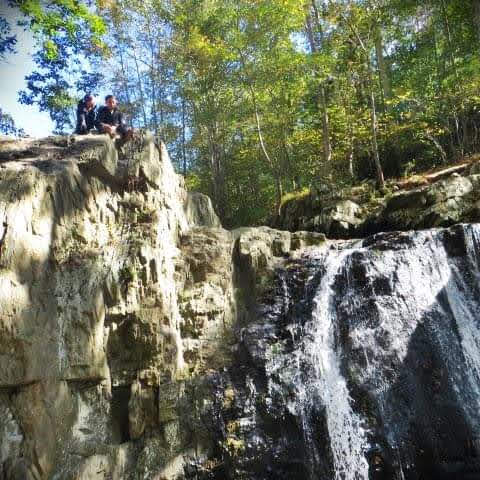
The view at the King and Queen Seat was gorgeous and iconic. This 190-ft high rock overlooks the creek below. I don’t recall the hike but I would go again if we are in the area.


Afterwards we had a nice lunch at Miss Shirley’s 🙂 We always treat ourselves after a nice hike! Their Chicken and waffles are always delicious.

Similar to Gunpowder Falls State Park, we drive by Susquehanna State Park many times to NY but we finally decided to check out a few trails early 2017. We also stopped by Conowingo’s Fisherman Park (dam) to watch fishermen and birds – apparently this is a very popular bird watching and photography area. It was massive and I enjoyed looking at the photography exhibit that people won awards for!
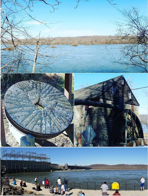
We parked by the toll house/rock run mill, and took the yellow trail (Rock Run Y) through the bare woods since it was still winter time. We followed the blue trail (Farm Rd) through the fields and then down the red trail (Susquehanna Ridge) along the Susquehanna River Valley. We did have to cross a small stream to return to the parking lot. I wasn’t counting how long we hiked back then but we spent a few hours in this area.
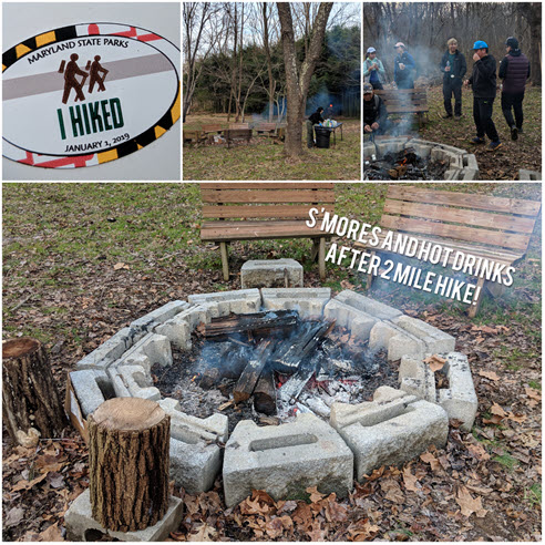
We decided to check out the 1st hike of the year, 2019, at Patuxent River State Park that we never been to in Moco (Montgomery County). It was cold and wet, I think we did half of the yellow trail in a group, lead by the ranger. At the end, we get a sticker and they offered some s’mores by the fire. That was fun but next time I’ll go by ourselves.
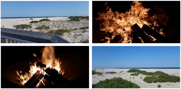
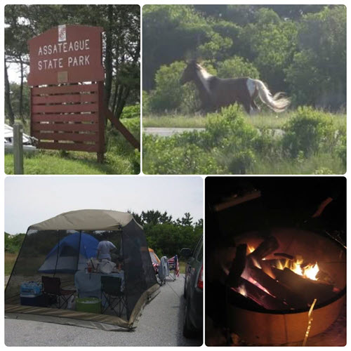
Assateague Island (AI) National Seashore requires a week pass, annual AI pass or annual NP pass to enter. There are plenty of parking, bathroom facilities, trails, and possible sighting of wild horses! You can also drive on the sand if you have a license, but there is a limit of how many cars are allowed to enter at an given time. There is also the Assateague State Park where majority of the folks would camp. Read about our camping experience in the section below.
Before I begin, I would state upfront it is mentally/physically exhausting to make it a day trip to/from inland and the seashore. Sometimes we stay at our friend’s beach house, hotel, or make the drive home. It also depends on the dates we go and how the weather looks for the weekend.
Our first few times we spent the night nearby and hung out at the beach most of the day, before washing off the sand and eating some seafood dinner at our friend’s beach house – yum! Sometimes we go back to AI at night for a bonfire, but you never know what lurks in the dark, it could be a wild horse or ranger! We’ve encountered both 🙂 It is a pain to lug wood and start a fire though, we ended up buying a beach cart (originally for work) to help bring along our stuff. We tried to dual purpose it for the beach but when it’s heavy, it is hard to pull through the sand regardless.
Our beach trips became more extravagant from when we used to just bring a beach towel and a water bottle to tan for hours under the sun. Over time, we’ve acquired sturdier beach umbrellas and beach chairs (both by Tommy Bahamas from Costco are good deals). We also got a half dome beach tent, pop-up tent for makeshift bathrooms/5-gal bucket, new igloos, pop-up chairs (one got burnt when it got blown into a fire pit), and quality clothes (Columbia brand long-sleeve sun shirts, hats, and pants) to protect our skin from the sun.
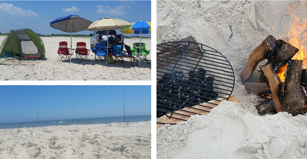
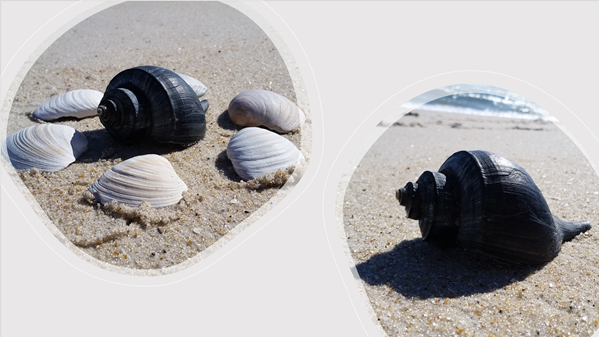
In 2016-17, we bought an annual AI pass and an over sand vehicle (OSV) license when we got the truck. So we could drive right on the sand and find a spot to surf fish (preferably not too close to others). These are usually a day trip with friends and we would have what we need right there on the sands. Whether it’s food, fishing or beach gear, it’s just steps away. We knew not to park too close to the waters because when it’s high tide, your car can get stuck in the sand. We learned how to lower the tire pressure before you drive on the sand and then pump it back up afterwards. One time it was washed out so they closed the OSV section and we didn’t check the Facebook page for closure before making the drive there, we were able to walk to the beach and found some pretty big shells!
Toward the end of the year, it was getting more cumbersome to plan day trips and we decided to get a hotel for a weekend. This was also the time we encountered the west wind and the horse flies were NO JOKE! They swarmed our truck, and we couldn’t even stand outside without getting a bite here and there (even when we were all covered up). Usually there’s a few flies that would bite us here and there but it was worse because the west wind blew them out of the “inland bushes”.
Since then, we haven’t really gone back to fish on the sands, and if we did, we typically had the annual NP pass so we could just park and walk with gears to the beach side for a few hours. We generally just rent houses in the Chesapeake Bay area (see the section below) or go down to Outer Banks, NC for the week (which I’ve a whole page about our favorite place).
Our friends booked us a camp site for the weekend on the State Park in May 2015 and we met them late at night after work. Putting up a tent in the pouring rain was the first and last time I went camping. It was pitch black by the waters and we accidently left the car light on at night, which killed the battery. Luckily we had another car to jumpstart it the next day. We grilled and had bonfires at night. We used the park’s facilities which was a quick walk away. The wild horses were always nearby and fun to spot, but remember to keep your distance so you don’t get hurt.
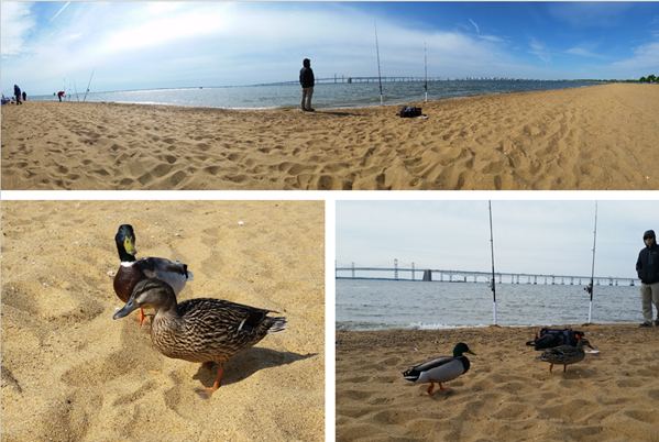
We’ve been up and down both sides of Chesapeake Bay area, primarily for fishing. We enjoy renting different bay houses with piers on the weekends to enjoy a quick getaway and some fishing adventures. But, we have also rented two different charters to catch rock fish during the season. We used to fish at Assateague Island National Seashore so you can read more about it in the above section. We also tried fishing at Sandy Point State Park, the Romancoke and Metapeake piers, Bill Burton Fishing Pier State Park, Elk Neck State Park, Oceanic Fishing Pier, and even off the 50 bridge going into Ocean City.
RENTAL HOUSES
Over the decade, we have rented houses on Kent Island, Tilghman Island, Cambridge, Point Lookout, Hoopers Island, and even down to Ophelia (VA). We have used a variety of websites (vrbo/homeaway, easternshorevacations) to look for rental houses, but Airbnb seems to be the easiest to book nowadays. It has gotten super popular country-wide since our first airbnb rental in LA back in 2015. We’ve only had 2 bad experiences out of 29 reservations where the rental wasn’t cleaned when we checked in but luckily, we had backup places to stay instead. Airbnb were always very quick to resolve the issues and refund us the money back.
RV
We liked Point Lookout (PLO we call it) so much the first time, we rented the same house twice but the second time, the fishing was not as productive. It was also located off a creek and fish traffic isn’t as vast as the bayside. We went back with an RV – read more about it in the Southern region section.
FISHING CHARTERS
We went on a small private charter with Captain Darwin and first mate out of Annapolis, so it was 6 of us ($100/person) for half day. We fished mainly around the pillars of the Bay Bridge and caught our limit of rock fish. I am not very good at casting and not getting snagged on the pillars so the first mate helped me a lot. We used soft shell crabs and sometimes were too slow to hook a fish. Toward the end of the day, we also caught white perches.
FISHING PIERS
When we fished on piers, the only pro was that you can make it a day trip and try to catch something within the state limits. I guess it was easy to start off fishing from here, or to take kids for a fun activity. Now we prefer the privacy of a house pier or open beach area. You won’t need a fishing license when you fish off a house pier, but you would need a saltwater license for beach areas!
The cons for piers are as listed:
- Typically a nominal fee to pay
- Must also purchase a fishing license, adults > 16 y.o. (depends on the water, you may need to buy fresh AND saltwater licenses)
- Limited parking
- No privacy/space between you and others (e.g. tangling of lines!)
- Carry your gear/igloo/chair/etc. with you
- Using the bathroom. Lucky if you have a porta-potty on the pier
CRABS!
If you are in MD and love seafood, you can’t leave without having a taste of our MD crabs. It can be steamed in Old Bay seasoning, fried (e.g. soft shell crab sandwich), baked/broiled crab cakes, crab soup, or buy a pint of crab meat for any other recipes you wish to make. Some favorites in MD we frequent are as listed:
- G & M Restaurant (Linthicum Heights)
- Timbuktu Restaurant (Hanover)
- Captain James Seafood Palace (Baltimore)
- Thames Street Oyster House (Baltimore)
- Lighthouse Seafood (New Market)
- Cameron’s Seafood (multiple locations)
- Hooper’s Crab House (Ocean City)
- Crab Wagon goes to dif Giant/Martin’s location
- On the Bay Seafood (Ocean City)
- The Shrimp Boat Restaurant and Seafood Market (Ocean City)
We have caught some crabs off the house piers using chicken tied to a string or crab traps you drop to the bottom, you don’t need a crabbing license here either. And we always let the females go so they can re-populate the bay for future generations. And there’s always a crab restaurant nearby where we could order bushels of them to eat in the backyard. But we typically catch some kind of fish to grill or fry up for dinner on most days. Some days we may not catch anything, but enjoyed being out nonetheless.
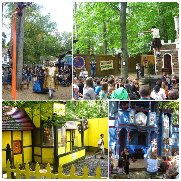
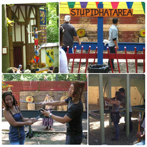
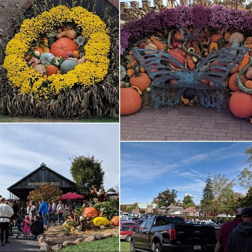
This isn’t a hiking spot but it’s one of our favorite activities to do in the fall. Visiting the Maryland Renaissance Festival in Crownsville. It has become more popular and crowded over the years, and you can only buy ticket online now, instead of in person there. It’s cheaper to go in the first 3 weekends they open (typically before Labor day weekend). Each weekend may also have different themes, folks love to dress up for this event. Here is a collage of us on the love bridge!
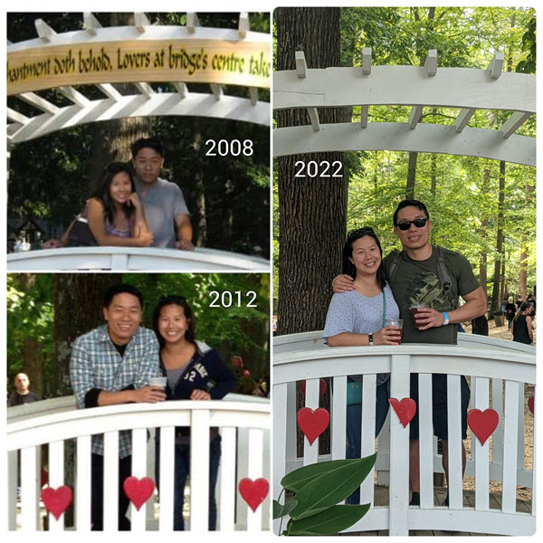
Our first time was back in 2007 and we typically go every year till 2019. But we have not since the pandemic, even though they opened back in 2021. We visited on a cool Sat day but the sun always come out blazing when we watch a jousting show. We’ve seen so many shows, tried the battle of the axes (you have to wear a stupid hat), dunk the wench, archery, games, drank beer and mead, ate turkey legs and ribbon fries, ride an elephant (I think it’s just ponies now), watch jousting and all kinds of fun stuff!

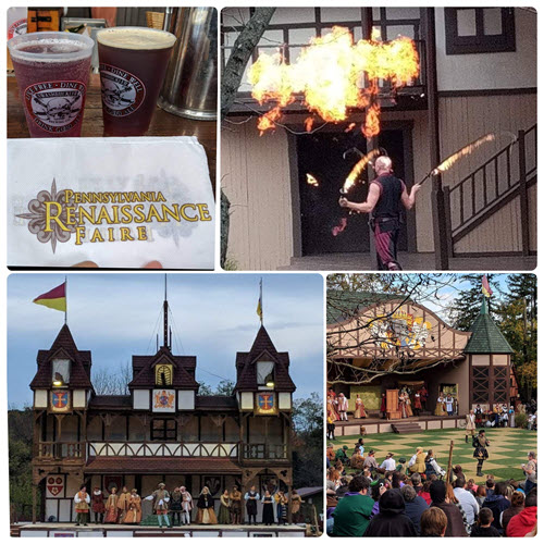
We did check out the PA version once in Oct 2017 but it’s just a long drive for a day trip and the food was worse than MD. The shows and games were different but not worth the trip back to PA.
This is on our to-do list one of these days, but weather and days off have been tricky to time right in the winter. We’ve always just passed through this region to the eastern shores, but recently found out they created a Byway driving tour guide that you can do on your own!
I also noted there is a Harriet Tubman museum in Cambridge (and the national monument is free to visit (although they are both closed on Mondays)!
I visited Sandy Point State Park once with my dad and we fished on the jetty back when I was a kid. All I remember is that my feet was all yellow at the end of the day, due to the mad made beach. It does have an entrance fee. We generally stay away from crowded beaches nowadays but we tried to fish in May ’15 and it was too cold. We met a duck couple who kept trying to steal our baits. It was an unproductive day, we didn’t stay long since it was also windy!