
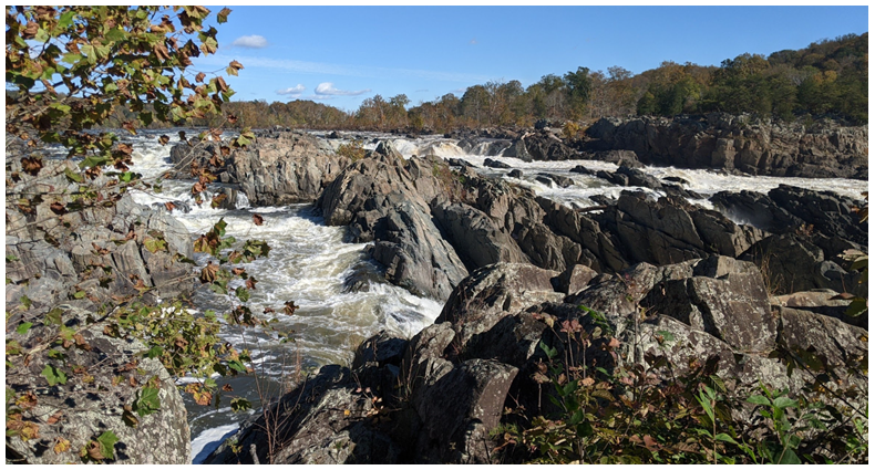

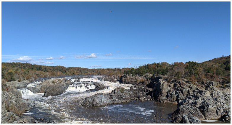
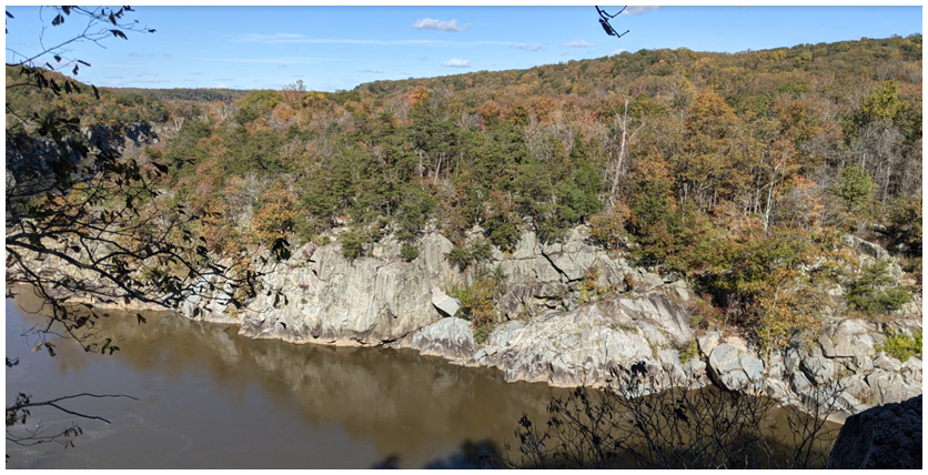
We continued down to the River Trail, walking along the cliff overlooking the Potomac River. Across the river, you can see others walking along the Billy Goat Trail A. We stopped by a plaque for Mather Gorge.

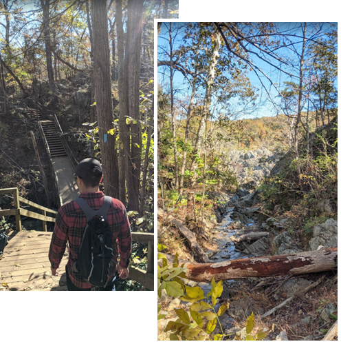
There were some areas where you walk across a rocky path and cross a few bridges. It was amazing to see the canal end, some reconstruction going on.
At the sandy landing, this is where you can see the hikers going up the traverse trail of Billy Goat A. We have been 4 times in total and will be featured on the Maryland page.

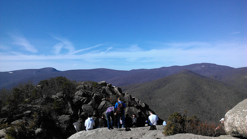
We continued on to the Cow Hoof Rock, which was an impressive view from this high up! (The Billy Goat Trail across the river continues on south).
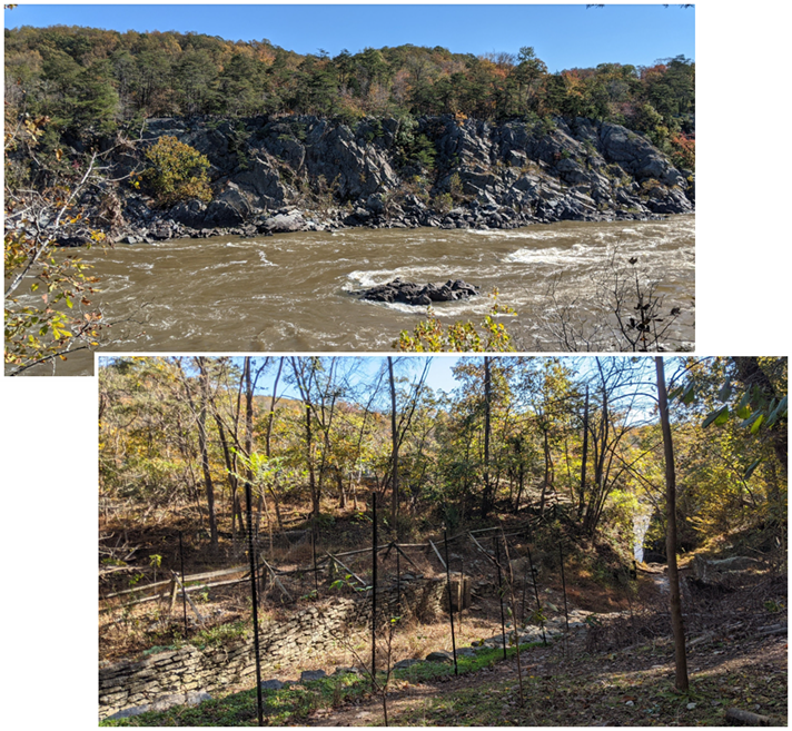
Then we took the Ridge trail and then Old Carriage Road back to the parking lot. These trails were very much like a fire road we’ve encountered at other places. We still like the MD trails better, especially the Billy Goat trail A (not B or C). So most likely we won’t be back in the future but if you have never been or you’re close by, it’s a good trail system to check out!
1. Natural Bridge State Park
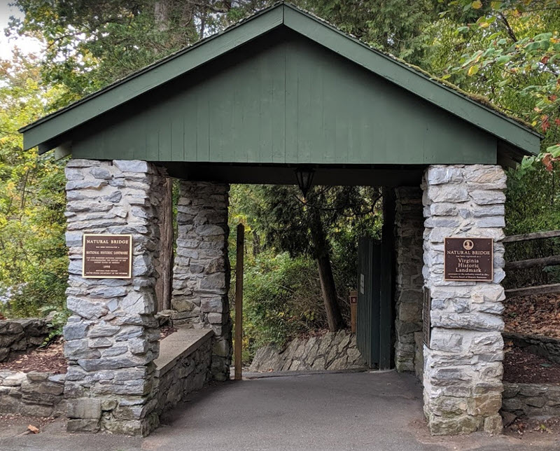
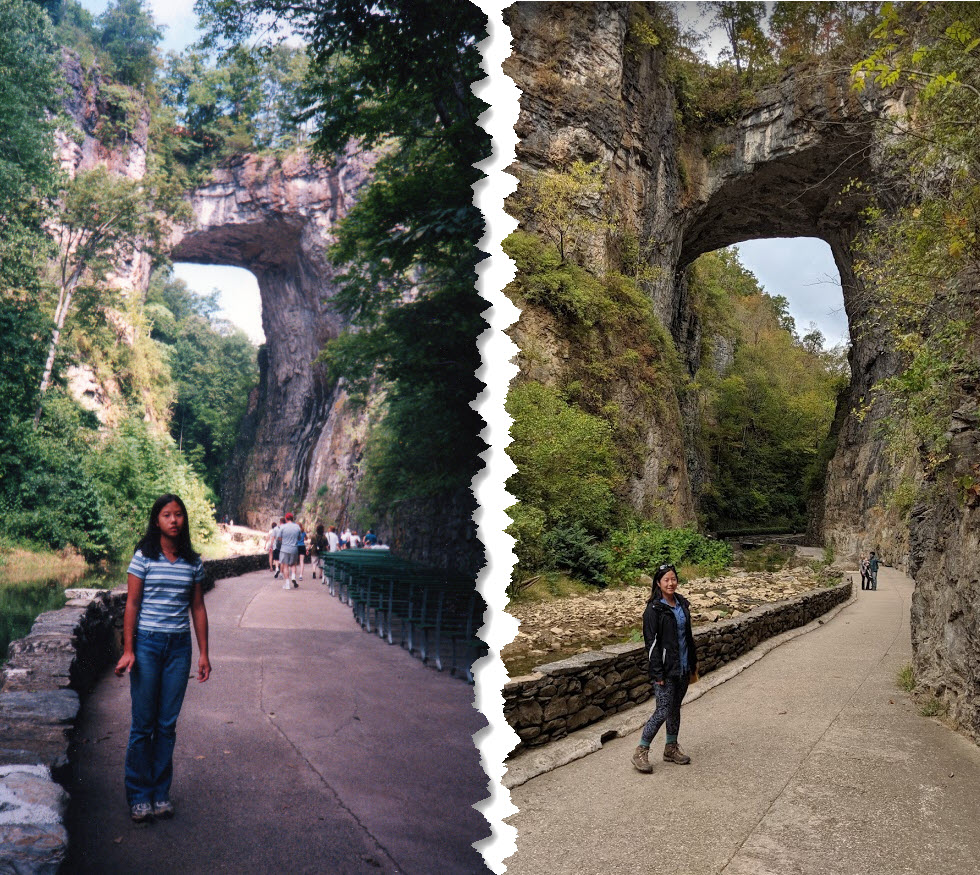
A little drizzle made the morning gloomy but we still took a walk through the park. It was $8 per person to access the stairs down to an easy, paved “Cedar Creek” trail where you can view the bridge from afar and walk under the formation. Apparently I was here when I was a kid (19 years ago)!
We walked through a reenacted Monacan tribe village and spotted a waterfall at the end. If you’re passing through or in the area, it’s worth checking out – otherwise, it is about 3-4 hrs south of Maryland.
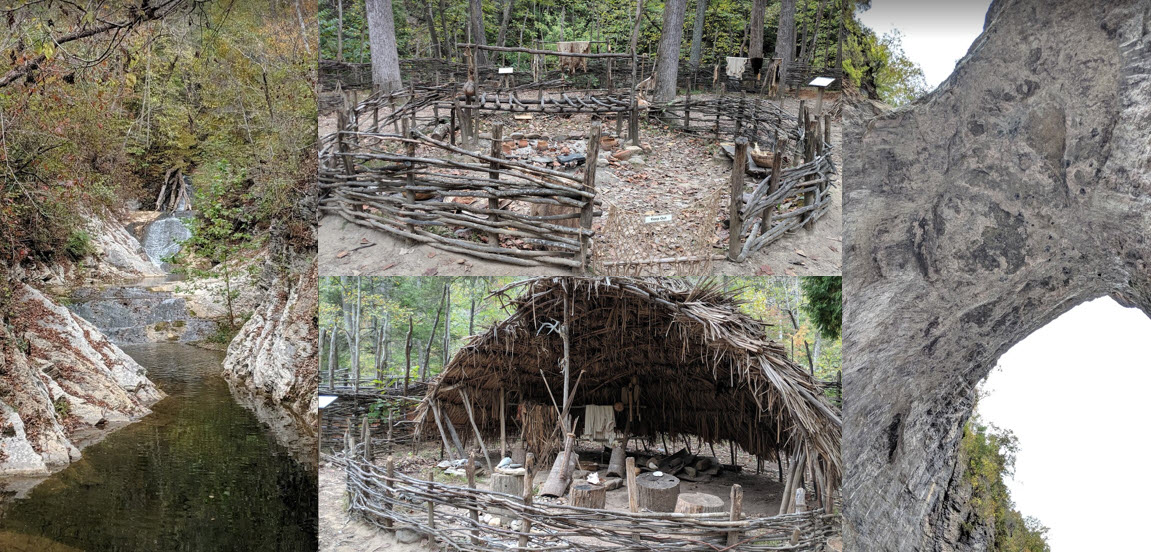
This enormous bridge reminds us of the ones we saw in Utah, if you ever go to Utah, you have to check out the bridges – you can read more on my Utah page when it’s available!

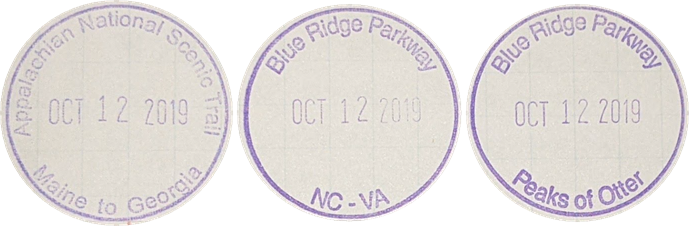
2. Peaks of Otter Visitor Center (VC)
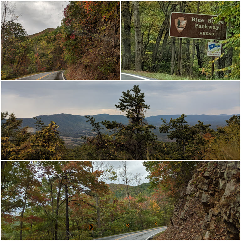
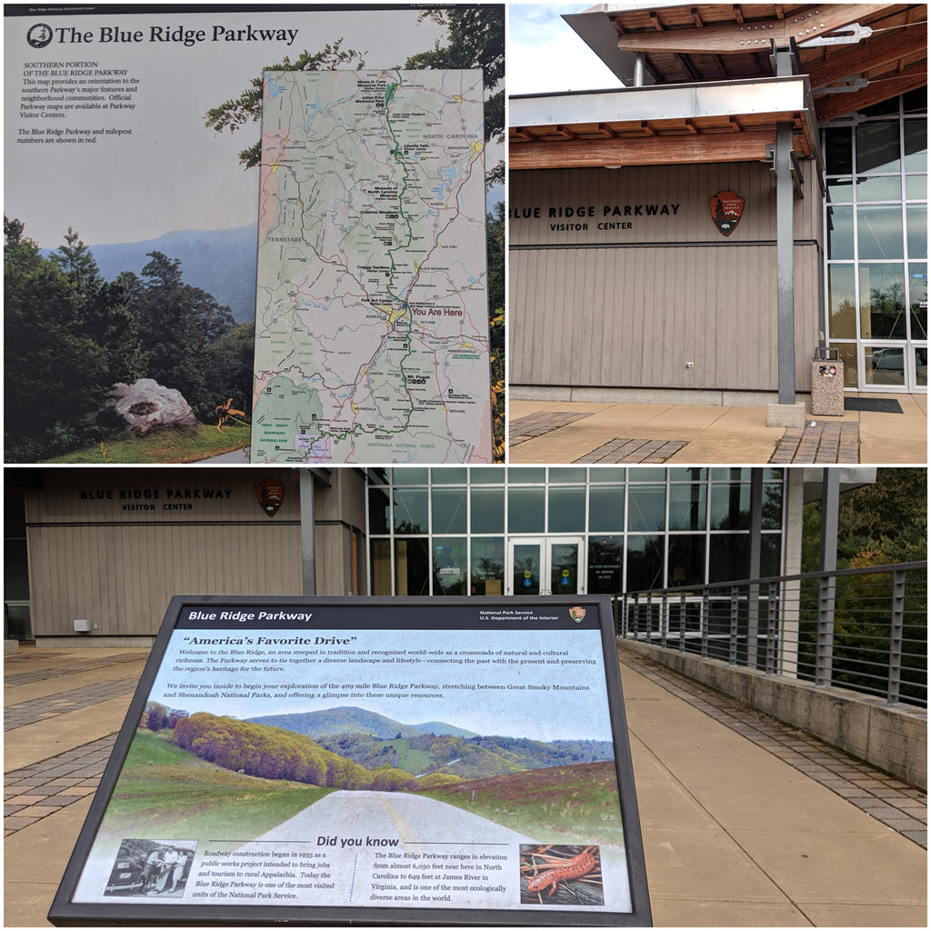
We popped in at our first VC on Blue Ridge parkway to grab a stamp. This parkway is the most visited in the states because it is free, so even though we had a NPS annual card, we didn’t get to use it much throughout the trip. There are many entrances to the parkway so I had to research ahead of time which hikes to hit up and grab stamps at all the VC along the way. Trees were still green as it was warmer than normal for mid-October.

We hiked a strenuous 1.5 mile up to Sharp Top, elevation 3,875 ft! It was sunny at the top but windy as we ate our lunch on one side of the summit (great 360 degree view though!).

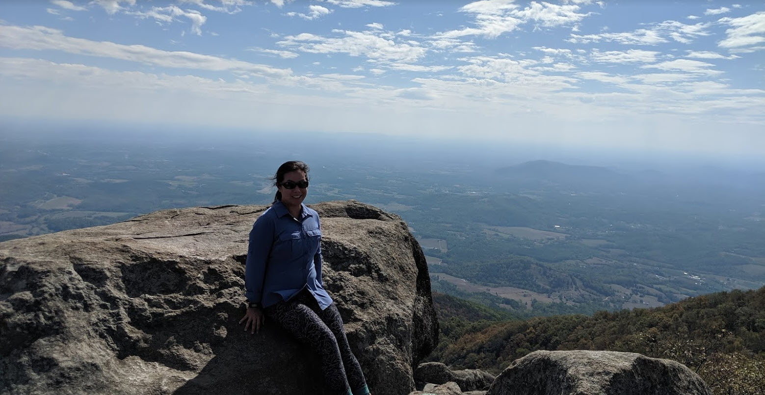
It was very popular and crowded as well, since the summit can be accessed by a bus shuttle for those that didn’t or can’t hike up there. We made our way down and continued driving to our first Airbnb apartment (Meadowview) to rest up.
Total Miles walked: 5 miles
Total Hrs drove: 6hr & 45 mins
Tips:
- Plan breakfast and lunch ahead of time, such as accounting for how many buns/croissants you need to make sandwiches. Typically we like to lunch at summits or somewhere with a nice view
- Keep your cooler cold with ice packs, especially if you have deli and eggs on board (I start with 6-egg packs until the next grocery run)
- Pack snacks like beef/turkey jerky, nuts or fruits for the hike/car ride so we typically don’t get much fast food on our trip

1. Roan Mountain Balds at Carver Gap
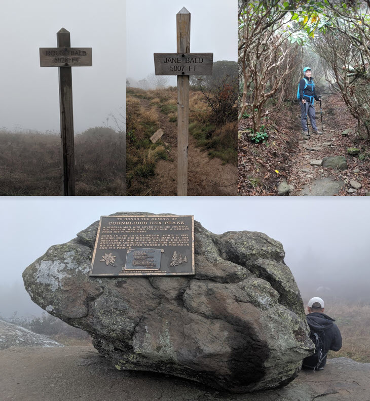
We woke up early and the morning did not look promising in terms of visibility. As we drove higher into the mountain, it was obvious that the heavy fog and cold mist was not going to clear up as we started the trail. Hikers were coming out of the Balds as they must have spent the night up there. It was miserable and cold, NOT at all what was described in a website when someone recommended checking out the balds if we were in the area. We couldn’t see past several feet, it reminded us of that time at Old Rag when it was in a similar condition.

We made it to the 1st: Round Bald, no view. We continued to the 2nd: Jane Bald, still no view. By the 3rd: Grassy Ridge Bald (gave up looking for the sign), we stopped for a snack hiding behind a rock and returned to the car (total 4.5 miles round trip). It was still quite popular as folks were waiting for our parking spot.
2. Roan High Bluff via Cloudland Trail (road closed for season)
Since the hiking condition and visibility was poor, we decided to descend out of the mountain and check out some waterfalls.
3. Linville Falls VC in NC
I do have a North Carolina page but I will continue our journey here as this was a passing through state while on the Blue Ridge parkway. We were encountered by many tourists alike wanting to see the Linville Falls – check out the available trails! Large and loud crowds made us anxious and we quickly chose the harder trails to visit. As most tourists would take their time on the easy, paved ways.
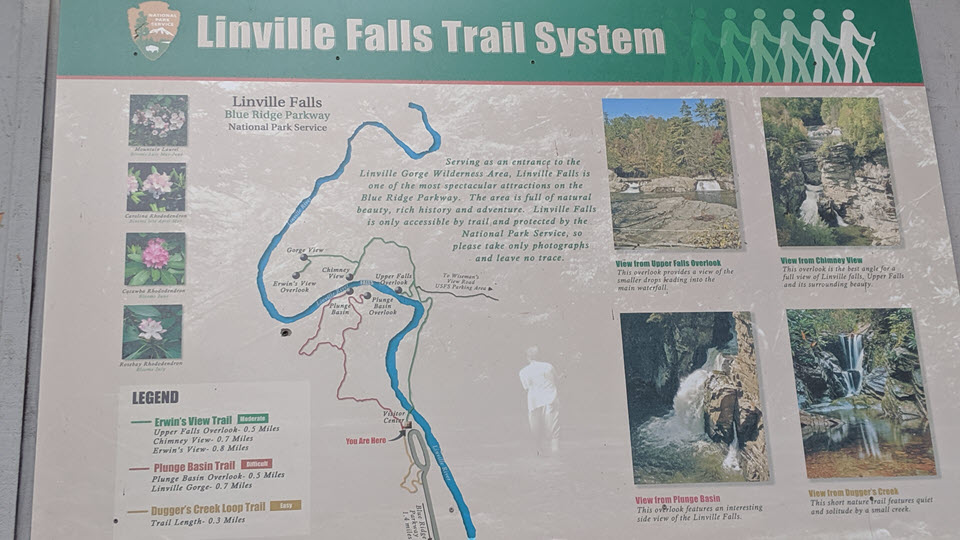
Following the Plunge Basin trail, you can see the upper falls and the other side (that had 3 viewpoints). We had a quick lunch by the rocks before continuing south to Asheville for the night.

4. Blue Ridge Parkway VC (Headquarters) in Asheville, NC
We had a time constraint where I wanted to visit the VC for stamps before they closed since we usually are on the trails so early the next day, we don’t get to the VC in time. I also wanted to grab brochures for any additional information I may have missed during my initial planning.
5. New Belgium Brewery in Asheville (Headquarters in Colorado)
We checked in our Airbnb first before heading out for a drink at New Belgium Brewery. We love some Fat Tire but also tried a flight of 4 samples (as circled in the picture below)!

We also tried a fresh pretzel and spicy mustard from a local vendor on site.

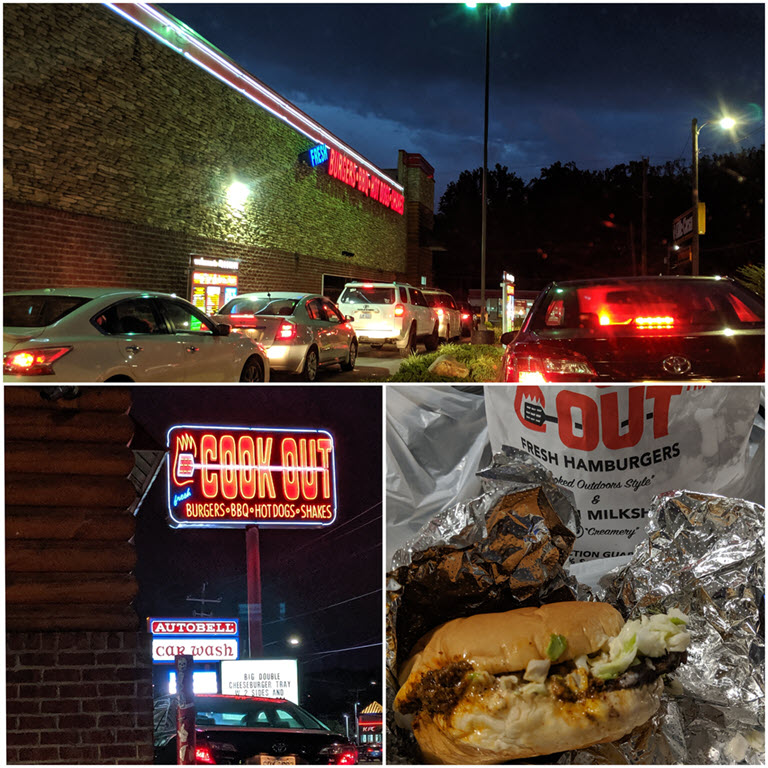
We picked up dinner at a local fast food called Cookout, which was famous for milkshakes and 2 lanes of drive-thru. We just got the original Cookout style burger, fries and chicken tenders before crashing for the night.
Unfortunately the rental wasn’t equipped with an oven due to a state law for rentals, so there was a portable grill for making eggs in the morning. We prepped our sandwiches for lunch and checked out early to work our way down to Tennessee.

Total Miles hiked: 6 miles
Total Hrs drove: 4.5 hrs
Continue to read more about the TN portion on the Tennessee page.

1. Roanoke, VA
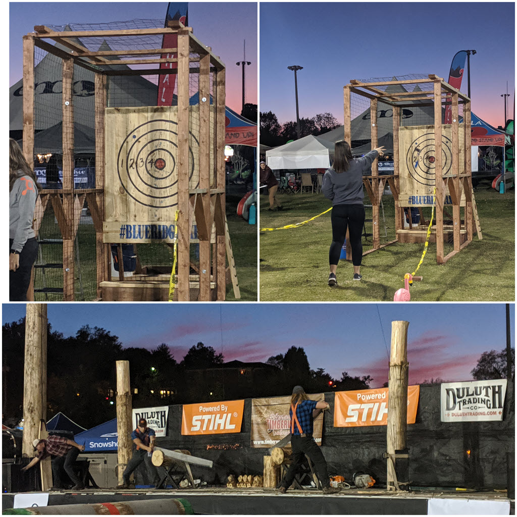
We drove straight from TN to Roanoke, VA (all day in the car was miserable!) We discovered a “Go Fest” happening that night so after checking in the airbnb, we walked across the street to explore this free festival that features the usual food/beer, activity vendors and the general idea of encouraging participants to “go outside”.
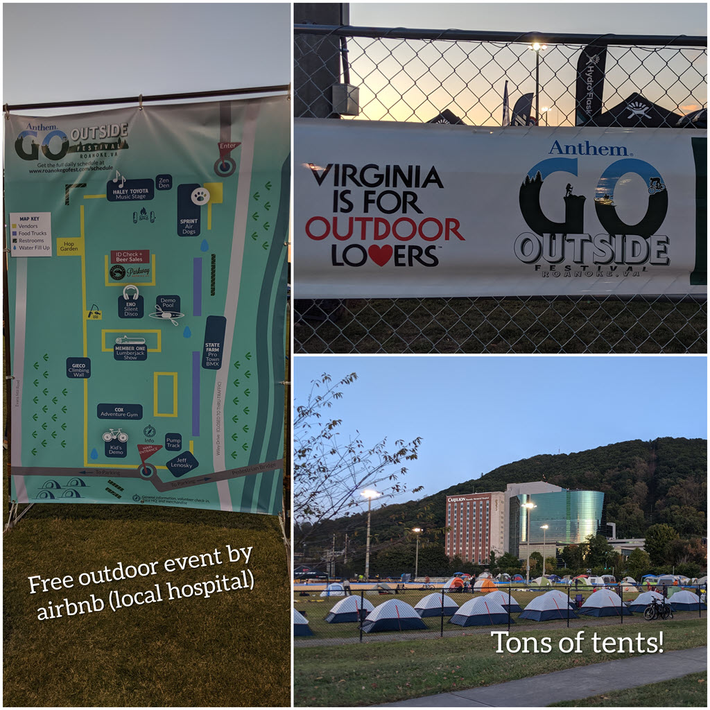
This festival is something that I wish was offered in MD, I dislike having to pay to enter the festival and then pay more for food/drinks once you’re in.

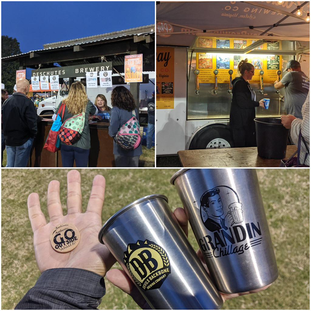
We walked around fire pits, music stages, enjoyed freshly popped kettle corn, and toured a teardrop camper (so cozy).


There were so many vendors showcasing their tents, bikes, and other outdoorsy items/activities. We turned in for the night but as light sleepers, we could hear our host upstairs moving around and the helicopters/ambulance at the local hospital.
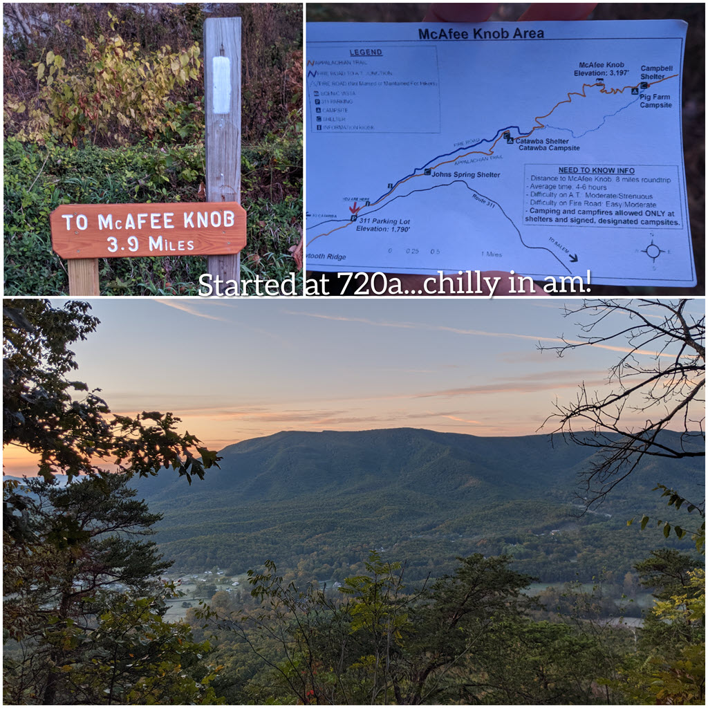
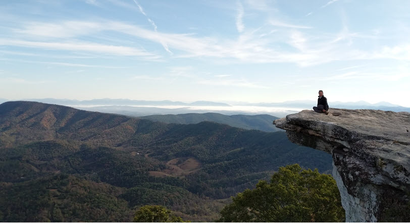
2. McAfee Knob
Early the next day, we set off to tackle a 8.4 mile hike to McAfee Knob (just outside of Roanoke). It took about 2 hrs to hike 3.9 miles (moderate/strenuous) where we took lots of pictures. Apparently this location was also filmed for a movie called “A walk in the woods”, I still have to look this up! We snacked as we took in the amazing views. This is one of the recommended hikes if you’re passing through!
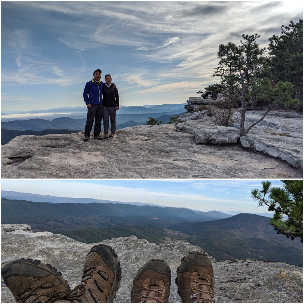
This is why it’s called the knob 🙂 By the way, it is still scary to stand/sit by the edge!
3. James River Visitor Center
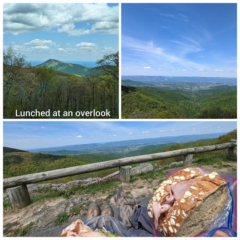
The next stop was James River VC as we drove north toward home. It was nice little walk around the grounds but we usually like to lunch at an overlook/top of a trail if possible.
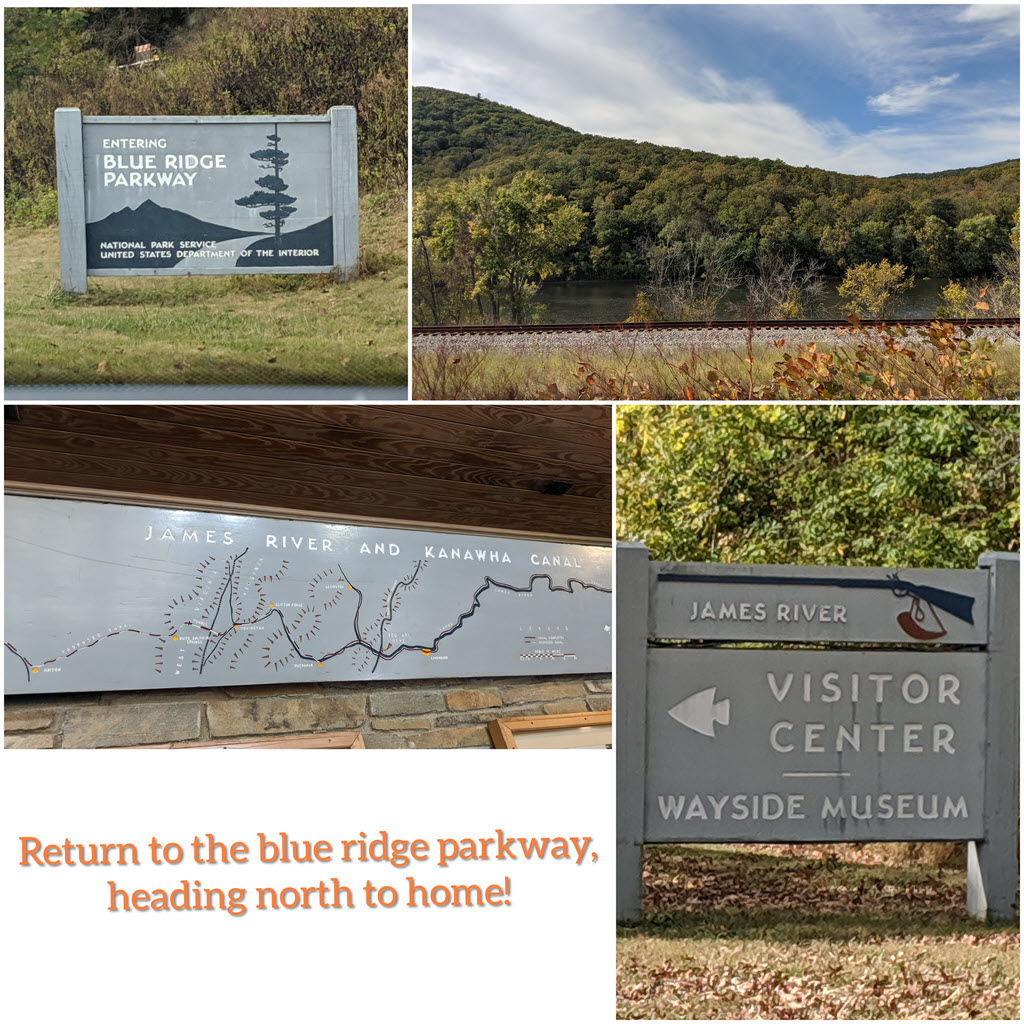

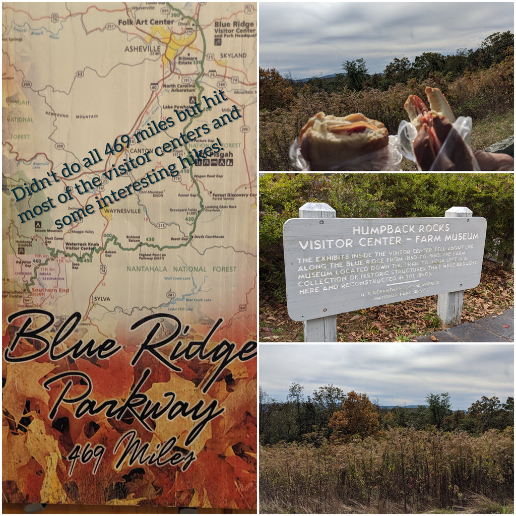
4. Humpback Rocks Visitor Center
We kept driving and just stopped at an overlook near this visitor center to enjoy the view while eating our sandwiches.
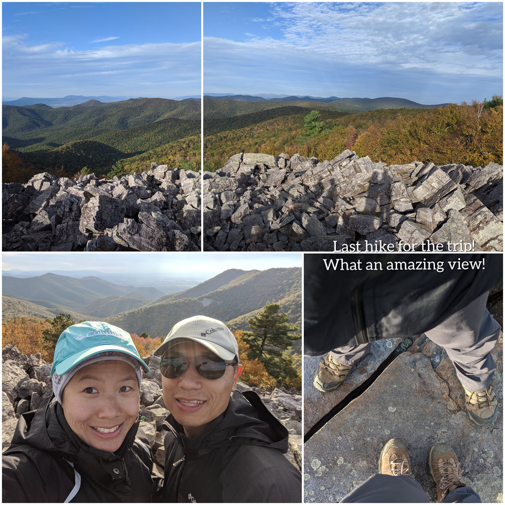
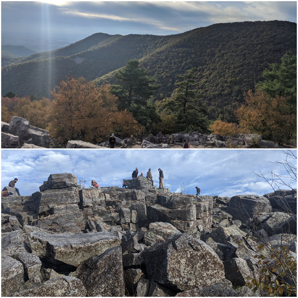
5. Blackrock summit (Shenandoah NP)
We also stopped by Blackrock summit for a quick hike (see more in the Shenandoah sections below) before turning in for the night with some yummy Thai food near our hotel. We ended our trip the next day by driving the last length to get home.
Total Miles hiked: 10 miles
Total Hours drove: 3-4 hrs
Tips:
- Throughout the trip, I would keep track of the money we spent on credit card or cash (e.g. keep the receipts, jot down numbers in notepad, or document right in the spreadsheet).
- At the end of the trip, we review all the charges and update the spreadsheet to get estimated vs actual cost for the trip.
- You can even make spreadsheets available offline so you don’t always need to be online to update it when you’re out and about.
- I try to save my data during our travels and recommend downloading maps over wifi.
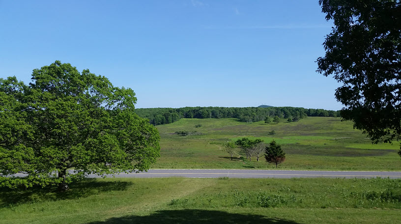
Once weather looked good one Saturday, we made a day trip to Shenandoah NP with our annual pass to visit two new trails we haven’t been on.

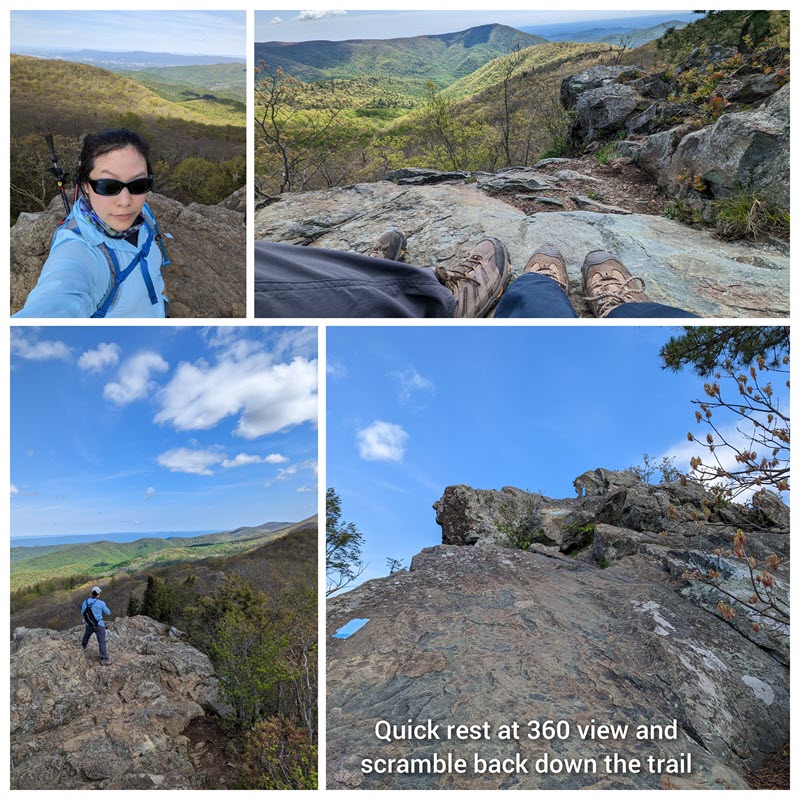
Bearfence Mountain, total 2.4 miles. Since the parking lot was already packed by 10a, we ended up parking off a small dirt lot along the AT. We took it backway up to the summits, stopping by the first 180 deg view. 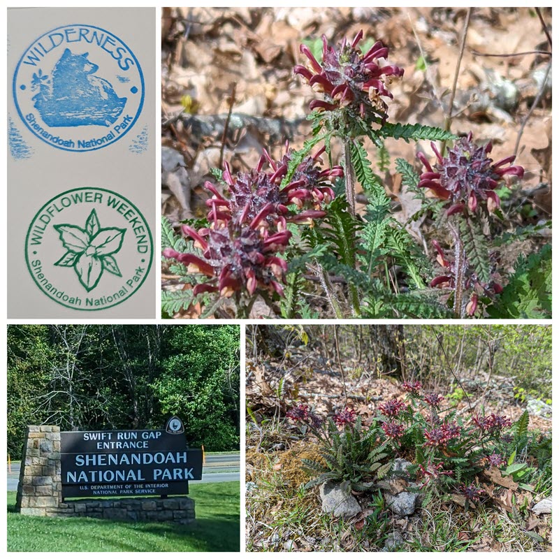
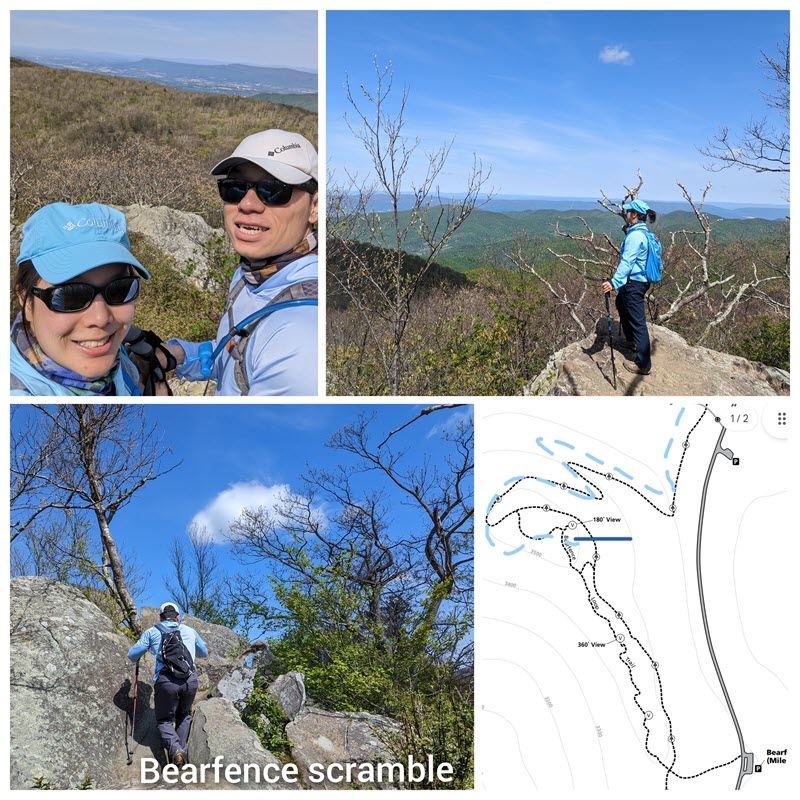 Then we scrambled our way up to the 360 deg view. The hike was slightly longer than from the parking lot but still relatively short compared to Old Rag. Great view for a “quick” hike, not hard at all with some rock scrambling by the 360 deg area (3,560 ft peak). Then we walked along the bottom of the rocks back to our car.
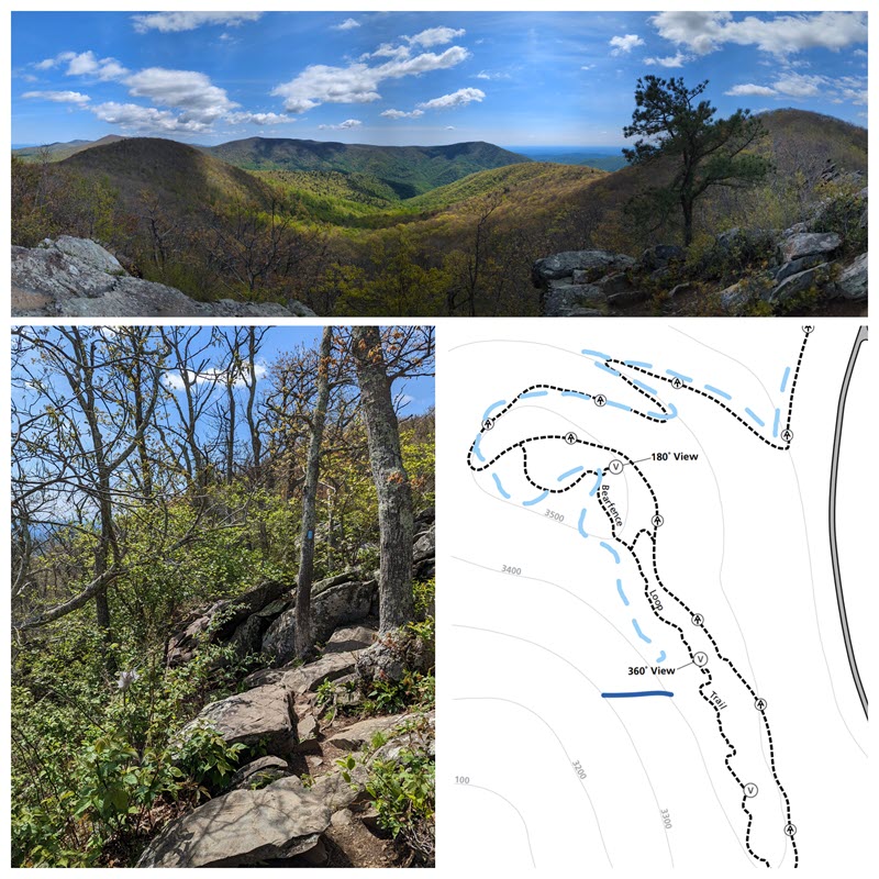
Stony Man, total 1.8 miles. Luckily we were able to grab a parking spot and walk the easy trail up to the Stony Man rocky peak. What a view! We snacked at the top and saw some others at the Lil Stony Man trail, as well, overseeing the Skyline drive.
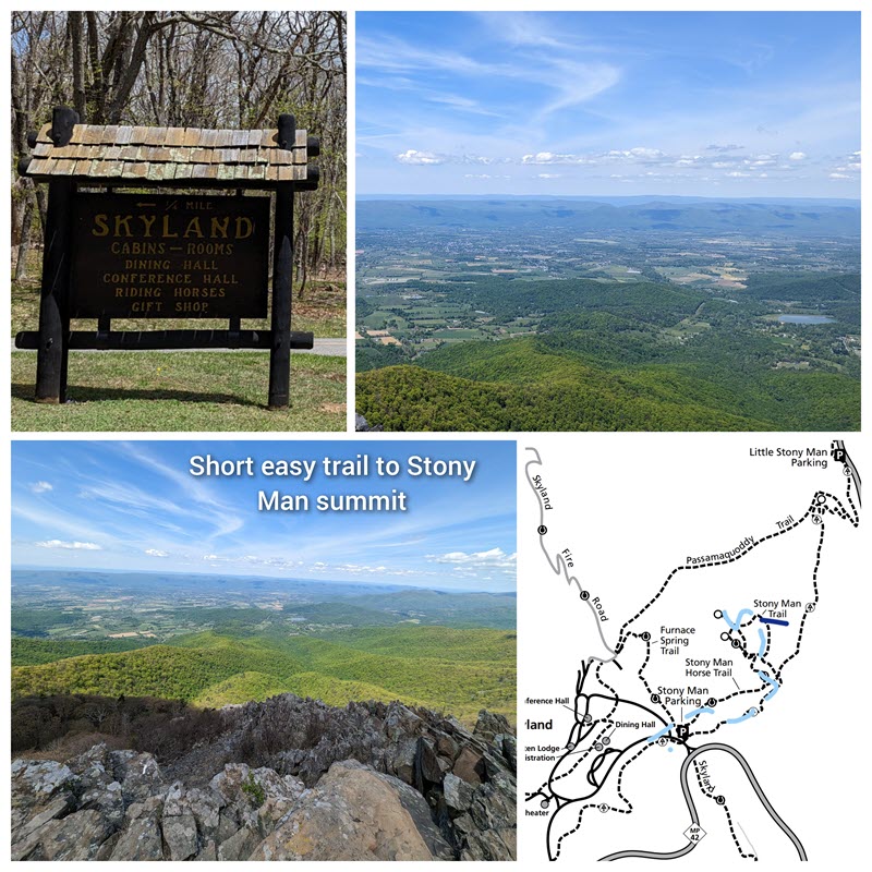
We were able to stop by the overlook to look up at Stony Man’s face we were just at! The sign talked about the “old man in the mountain”, a Shenandoah NP icon. His facade is greenstone, a metamorphosed ancient volcanic rock. This is the 2nd-highest peak in Shenandoah! The drive home was drowsy and it was stressful being back in the hustle bustle of VA traffic.
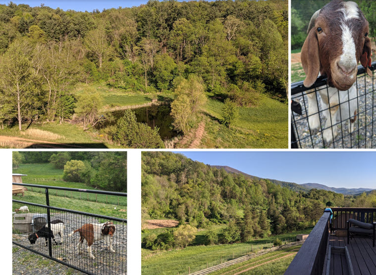
A weekend getaway with friends, so we went exploring in the area. The rental house was situated by the woods, with a pond and goats on the property. We also did some grilling on the deck – the weather was nice but windy!
On a Friday morning, we drove down a narrow/windy road to the top and past the Massanutten Storybook Trail, the paved road ends. It was a good few miles on gravel so go slow (recommend taking a higher clearance car). We parked by “Scothorn Gap” trailhead, which had a little parking lot and can fit ~5 cars. It was still early (930a) so we were the only ones, and made our way up the fire road (see Hiking Upward directions). It got windier as we made our way up and some sun peeked out.
At first I thought we missed it and then found a newly constructed sign and pink blaze rocks/trees. We did some rock scrambling that made me hesitant in certain areas. It was sketchy because of the high wind warning that day, in addition to high pollen level. Our sinuses were dripping and the fear of getting blown off the edge of the mountain kept us going.
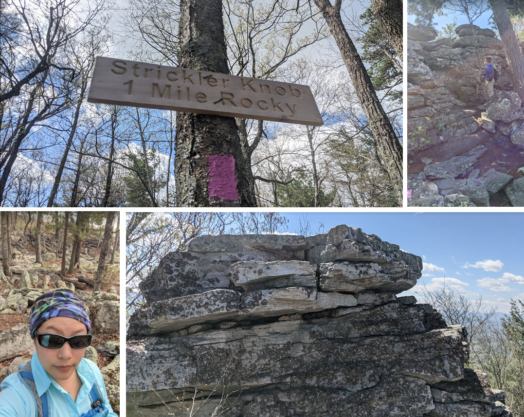
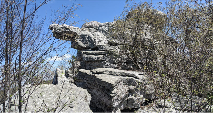
Overall, we did not enjoy the trail, probably due to the windy conditions but it was also out of the way. If you want some rock scrambling and great views, check out Old Rag in VA (although it is lengthier). We had a quick snack but it was just too windy to enjoy the view. But here it is, the Strickler Knob!
We scrambled down the rocks again and found a rock wall to hide behind briefly to rest before heading back down. It looked like someone had the same idea of shielding from the wind and made a little campfire. We passed by a few other folks, one who offered to take our pictures. I did end up twisting my ankle a bit from the rock trail so it was not comfortable to attempt Tibbet Knob the following morning. It was close enough that we had planned to go but not with the allergies and ankle. So, we only clocked in 6 miles total for the weekend trip!
Otherwise, the trail down was uneventful until I heard a rattle to the right of me. I stopped and he pointed out that it was a rattlesnake. I never saw one in person and zoomed in to see the snake hanging out by the log. I didn’t capture a video of the rattle sound but I’m glad I did not step on him! The rest of the day we suffered from allergies and took some more meds to calm the sinuses.

Tips:
- Check the weather, especially wind speed and prepare to take some allergy medications ahead of time. Once it starts dripping, it is usually hard to stop it until you take another dose of medication!
- Be prepared in case of encountering snakes (I wouldn’t know what to do but to rush to the nearest hospital since there isn’t any cell signal for a few miles up there) or sustaining minor injuries. We typically do day hikes so we don’t carry a first aid kit but we do always carry plenty of water and snacks! We don’t always wear a headlamp since we go early in the morning and never run into situations where the sunlight is fading (sunset).
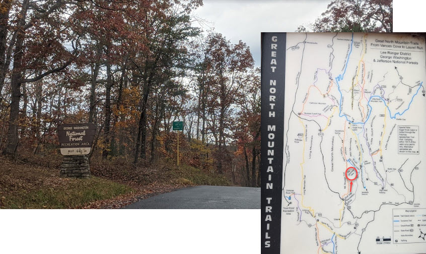
During 2020, most if not all parks were closed in the beginning. Even after checking the websites for updates, we hesitated with going on trails more than 30 minutes away in case places were still closed (parking not accessible). By the fall, the public was already out in full force at the beaches, so we started to venture out to parks again with our Buffs around our necks. They are quite versatile and it was what we used initially during quarantine. You can find them online or at the REI stores! Since then I’ve sewed a few masks to keep in our cars and rotate in spares. My friend posted her adventure to Big Schloss and I did my research. It was a 2.5hr drive to the Wolf Gap Recreation Area so we had to pick a decent day but in October, it’s hit or miss how the weather is this month.
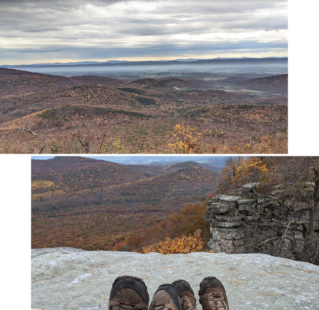
We were prepared to go at any time, even if it was risking a 60% chance of rain but I was itching to squeeze one more hike before the end of the year. So we left early Saturday morning and encountered patches of light rain during the drive. Parking spots were quickly becoming limited but we luckily parked on the side of the recreation area loop. Loads of campers and hikers were already milling around, we started our ascend on this trail (4.2 mile RT).
We made it to the top, crossed a bridge to a 270 degree view and enjoyed our usual sandwich lunch at a spot away from others. I appreciated that the majority of the other hikers kept their distance or at least covered their faces when passing others on narrow paths.

Toward the end of the hike, since my legs were tender and some parts of the trail were slippery due to fallen leaves on rocks, we decided to forego the Tibbet knob (sister hike) next time. We thought we could do both hikes but there wasn’t much time and return to our anxious dog at home.
Tips:
- Check the official state or national park websites for latest updates (aka closures)
- Encourage a Buff-like face covering during hikes, it soaks up your sweat, keeps hair out of your face and becomes helpful when using the bathroom facilities (as the smell worsens in the summer heat)
- Plan alternatives if you run out of time (must do’s and if you have time), know sunset time and pack headlights if you plan to be out after the sun sets
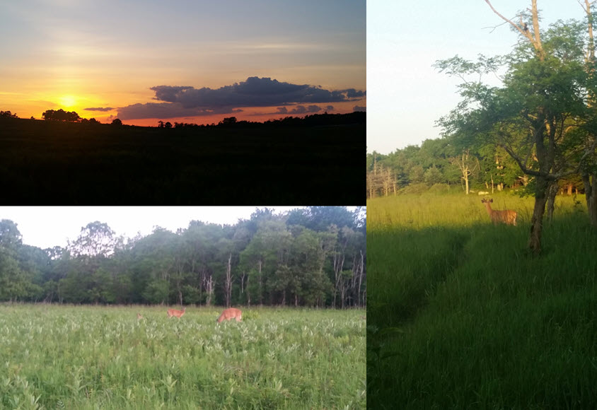
We ended our BRP/TN trip with a quick hike to the Blackrock summit within Shenandoah NP. We entered through the Rockfish Gap entrance, which is the southernmost part of the park! It was actually more colorful here than the first part of our road trip when we trekked down from VA to TN/KY.
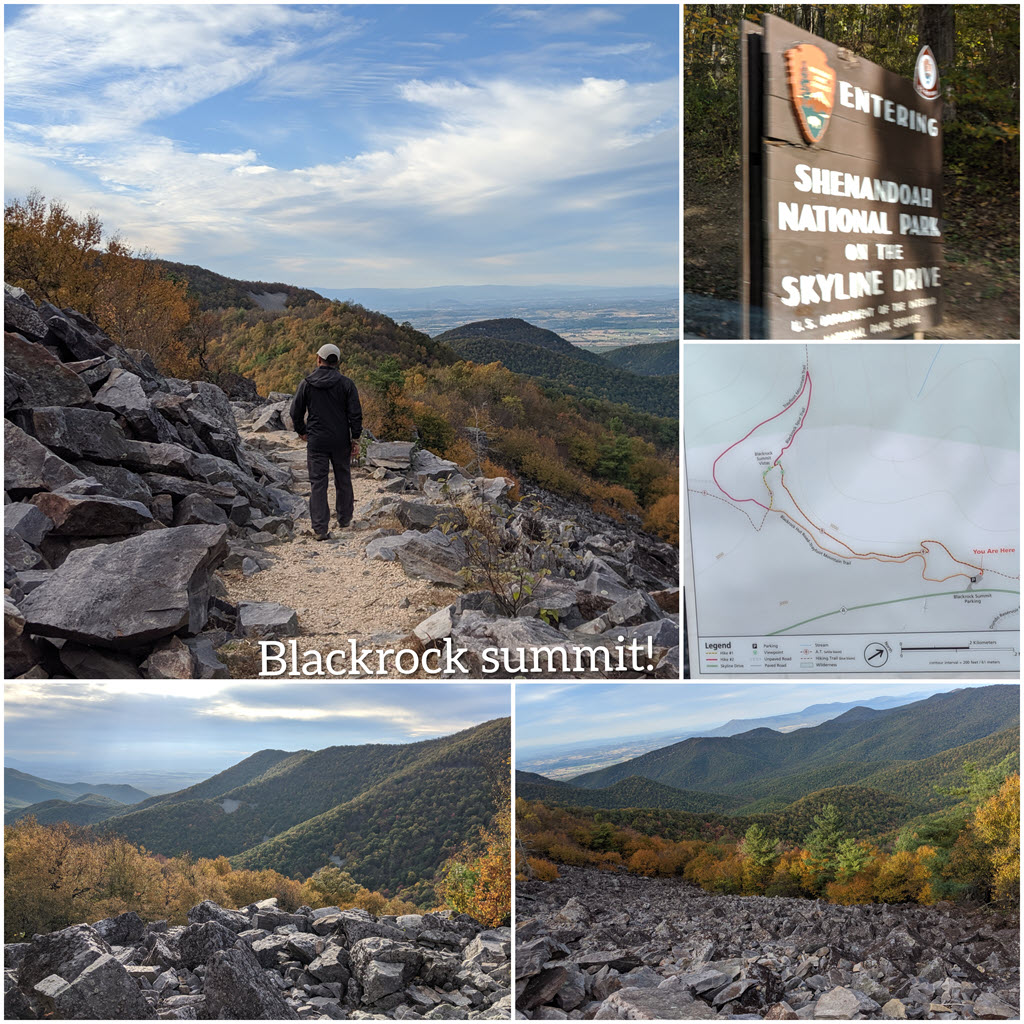
We started off going toward the wrong direction but corrected course and made it to the unique rocks – see info. It was a short, 1-mile circuit hike and it was popular. The parking lot was full but people come and go so be patient!
It was also a little gloomy when we went so we skipped other trails in that area to turn in early on our last day of a 9-day trip! This place I would recommend checking out if you’re ever in the area!
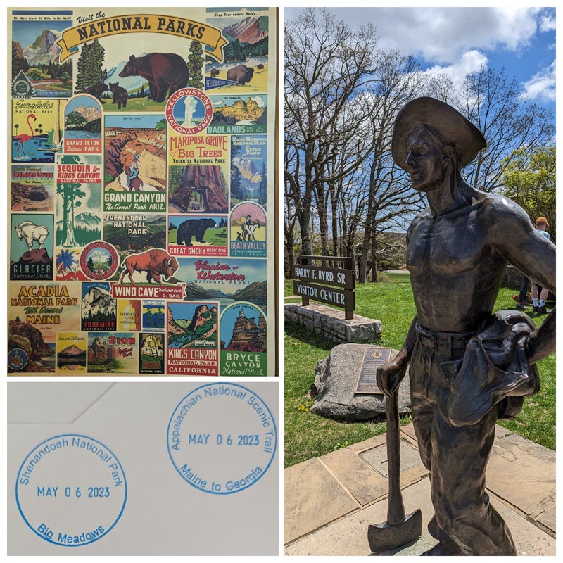
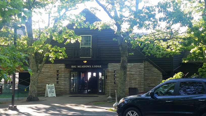
We attended a free REI class to review the best hikes in and around Shenandoah National Park – check out the presenter’s blog (he talked about lots of fungus among his hikes so we kept our eyes peeled). So combined with this new knowledge, we decided to combine a few hikes with the guided twilight hikes offered at the park. We finally booked the tour ($20/person) and a room at Big Meadows (rate dependent on season). Even though it was June, the Big Meadows is located at high elevation resulting in cooler summer nights. We left the window open at night as there is no AC in the room but there was a fan in the closet to circulate air.
During the day, we drove through the Skyline drive and encountered a mama bear with two cubs on the road (around the bend!). We hiked two trails: Compton Peak (2 miles RT) and Hawksbill Summit (1.7 miles round-trip (RT)). See respective pages linked:
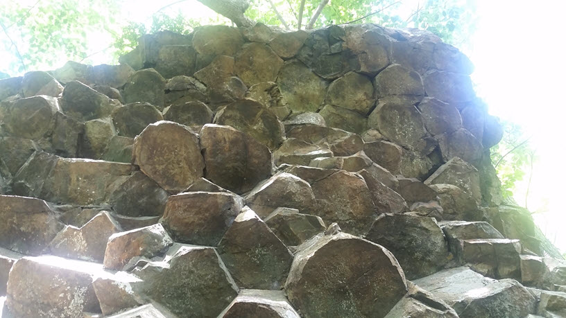
- Compton Peak (west) features columnar jointing (you have to climb down to look up!)

- Hawksbill Summit was a steep incline to the tallest peak in the park with a 360 degree view!

We checked into our room at Big Meadows Lodge before grabbing dinner. We prepared in long sleeves and pants before meeting the tour guide at 630p.


During the hike, we learned a lot about the ecosystems of the meadows and saw many deer. After the tour, we saw a big full moon, so no Milky Way that night. Since then, I have been determined to go to a dark sky park to see the Milky Way one day!
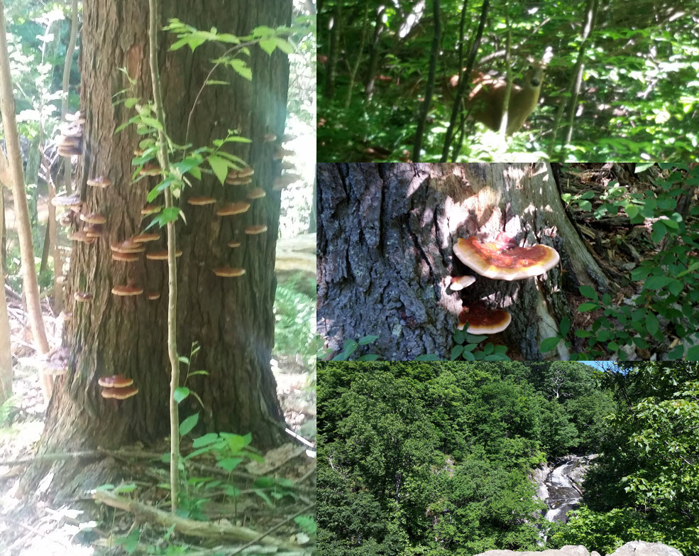
After breakfast, we had an option to order lunch boxes to-go before heading on the Whiteoak Canyon trail (4.7 miles RT). We saw some wildlife, including a deer a few feet away from us and spotted some mushrooms the guide mentioned. We took a break at the view of the upper Whiteoak Falls before returning to the car for home.
Tips:
- Review the Shenandoah map and look up the trails you want to explore (via official website or other hiker’s sites)
- Be prepared for night hikes with long sleeves and pants, ticks are always a higher possibility so check your clothes afterwards too. Use DEET spray on clothes, rather than your skin (it is quite sticky and can stain certain materials)
- Pack or plan when to stock up on meals, know what time they are opened (some places may lose outside of popular seasons)
- Make sure to fuel up your car before entering the park, or know where the closest gas station is (there’s only one off the whole skyline drive). It is important to also download offline maps as most phone services tend to lose service the further you get into the park
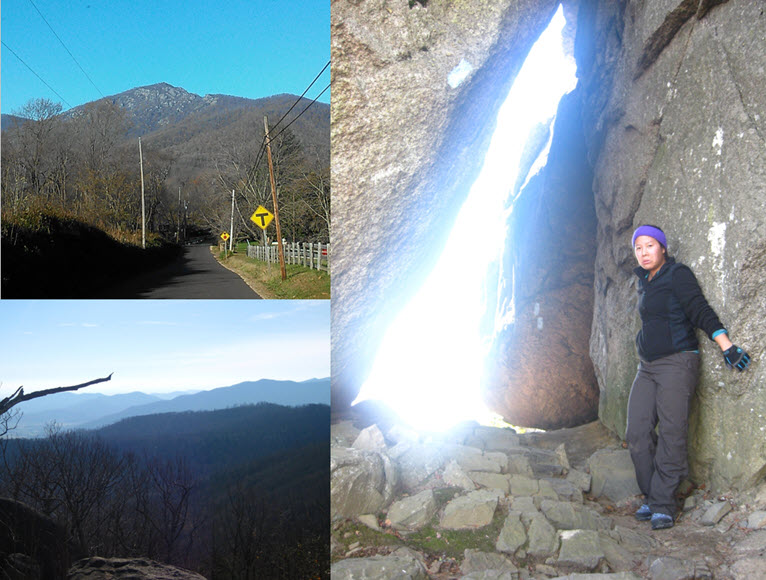
We opted to stay at the Skyland Resort after we hiked at Old Rag Mountain for the first time. To read about that adventure – scroll down to Fall 2012. We tried to enter the Skyline drive at Thornton Gap entrance station but it was closed that day so we had to drive 30+ miles north to the Fort Royal entrance and then another 30+ miles back down Skyline Drive.

It was dark by the time we checked in and enjoyed dinner in the dining room with others. There was no cell service, nor wi-fi or tv in the room. We enjoyed a quiet night resting our bodies. The morning was breathtaking to see the light mist and snow dusting from the cabin’s window. We had a delicious buffet breakfast and headed home.
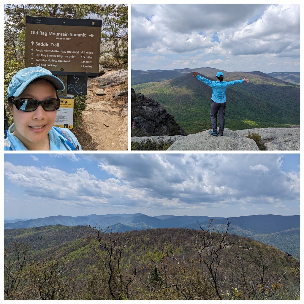
We returned 5 yrs since our last visit and used our annual NPS before expiring in April by going to Old Rag. The weather was 80s, sunny, and we had bought tickets 4 days ahead. It took 2 hours and the other two parking lots were filled up already. These were new with a ranger station and bathroom, so we still parked in the OG overflow parking lot with portapotty. Instead of walking on the road, there’s a small trail leading back to these new parking lots. This is where you show your NPS card at the ranger station and she scans your Old Rag tickets. Here is the start of the new Ridge trail, and then up and up we go.
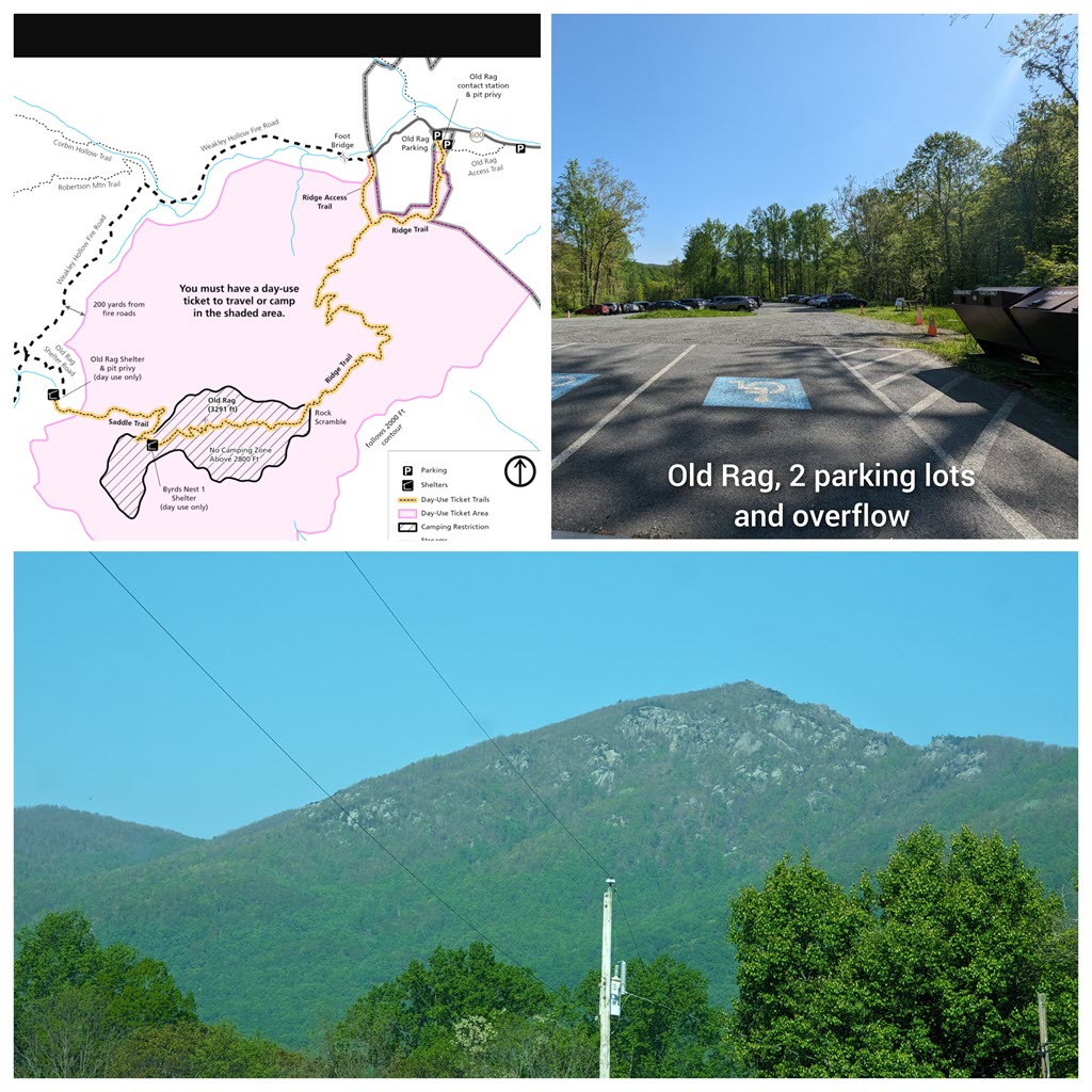
Lots of switchbacks, some big rocks to rest at, and plenty of snacks. We got up to the rock scrambling sections. There were two areas we had to wait 10-15 min for people in front to finish taking picture or climb up a tough section. I still needed a “tush push” up one section, but otherwise, it was fun crawling around, and finally, we made it to the summit (3291′) by 1p. It was blazing so we ate under a shaded rock.
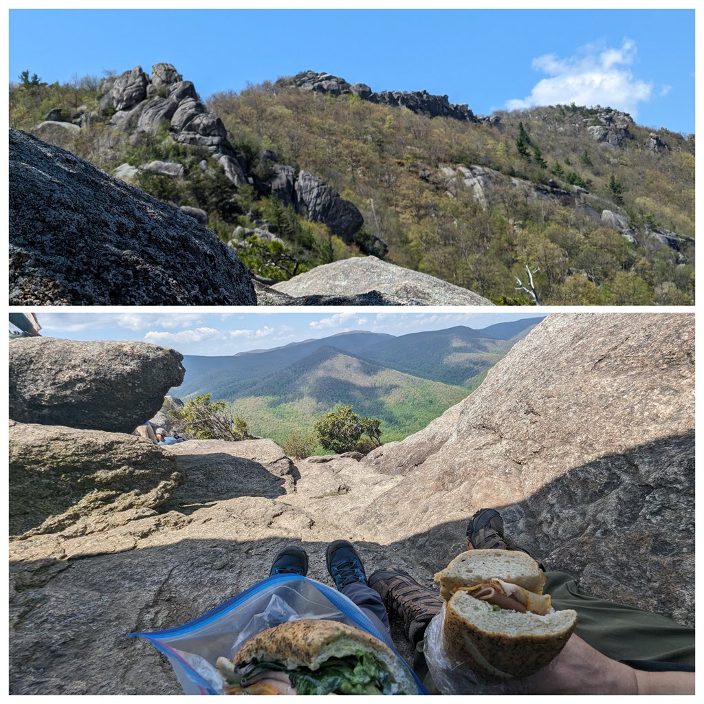
There were still about 700+ folks on the mountain with us. One guy was taking tripod pictures, a lady was doing hula-hooping, and others were chatting in groups. Most everyone was super nice and we let folks who’s faster pass and vice versa. This is close to our Mt Fuji elevation gain (4842′), so I’m looking into other nearby places to train for our Japan trip soon. I’m a little worried about altitude sickness so we’ll take our time.
It would be too crowded to go backwards on rock scrambling and return the path we came up. So, we took the Saddle trail back down to the fire roads. We saw a few coming up that way (skipping rock scrambling/crowd). There was a closed privy by the shelter and 2 portapotties by the fire road. But I decided to hold until we got back to the parking lot so it was a long 5.2 mile back. Even though 2 hours wasn’t a bad drive, there’s always traffic around 495 Tyson area.
It has been a few years since we first discovered Old Rag, we always reference it in conversation so we decided to hit it up on a nice (non-humid) day in June. It took us no time to reach the top, enjoyed a sandwich for lunch, took some pictures and then took the long/boring way back down.

It felt much faster (finished within 6 hours) but definitely had some blisters walking along the rocks on the “fire” road. We may have been rushing down the side of the mountain and could have easily sprained our ankles, so just be careful where you step!
Tips:
- Make sure to have sturdy hiking books and wool socks
- Buy mole skin or use other skin protectant products to protect your feet!
- Have cash or your national park pass readily available in the car
We went against our own advice of checking the weather, we knew it would be “drizzling” but we still proceeded on this journey. We also forget that higher altitudes may have frozen areas due to cooler temperatures. Now I account for that altitude tip and as we get older, we are more cautious of getting hurt.
Everyone put on their “rain” gear of some sort (whether a poncho or trash bag), it was necessary to keep your body warm as the wet weather can really dampen your mood. We were leading our friends on their first hike through Old Rag, stopping frequently for pictures and breaks. As we neared the rock scrambling portions, I needed a little more help and eating cold lunch was miserable in the mist. You could barely see past 15 ft in front of you so there was no view for us that day.
As we proceeded to descend around the mountain, it became obvious that the trail was half frozen so we made our way down the trail on our butts until it was safe to walk on. I don’t recall the total time it took us but definitely a full day’s worth. We were exhausted and cold by the time we got back to the cars. But, a hot soup meal was just what we needed afterwards!

Tips:
- Go with your gut about cold weather, reschedule if needed or make sure to be prepared for all cases
- Opt to bring hiking poles if you have them, it was helpful with the descent and saves your knees
It was our first long hike (8-mile), we didn’t know what to expect but we knew to pack enough snacks and water. It was definitely challenging at times, but the view was rewarding. It started on a gorgeous Veteran’s day and free parking (pass not needed) was a plus! Since it takes us at least 2 hours to reach the parking lot, we had to pack everything the night before and make sure to start the trail at so-so time. Typically we like to beat the crowd at popular destinations so we aim to be on the trail by 7-8am already. Plus, parking later may be an issue so I rather wake up early and enjoy the morning views.
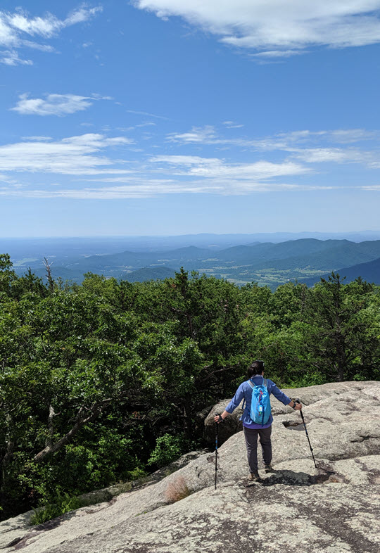
The circuit starts most people off from clockwise around the mountain, even though the trail isn’t one-way per se. The first few miles were a steady incline zig-zagging up the mountain. People passed us, but we also passed others. The second portion was some rock scrambling. There was a section where you had to pull yourself up a rock and proved a little difficult but manageable. It does get a little bottle-neck in these areas when folks choose to return down the path they went up. The third portion results in an amazing 360 degree view of the Shenandoah region, elevation 3,284 ft! You can spend time resting, fueling up and/or taking pictures for memories.

When it’s time, the last portion is to return down the mountain on the other side and follow the fire road back to the parking lot. This portion was long and boring, as your legs feel like jello and can’t wait to sit down for the rest of the day! I can’t recall how long it took us, but we spent a full day (at least it was all daylight from beginning to end). But, it is an accomplished feeling when you finish the loop! I hope you get to enjoy it one day!
Tips:
- Go early for ease of parking and less crowd in the mornings
- Enjoy the view – plenty of space to spread out from others
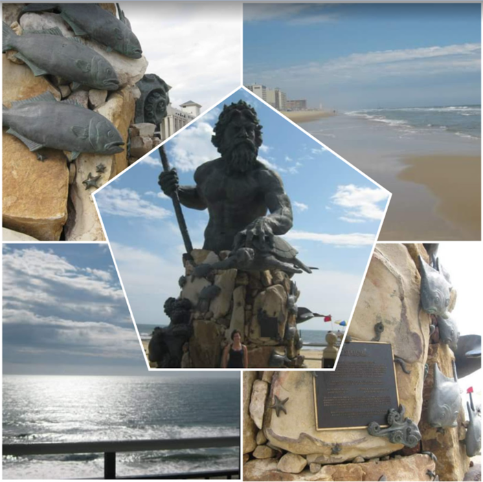
We took a mini 3-day vacation to celebrate graduation and checked out Virginia Beach (since we frequent Ocean City growing up, we decided to go a little further south). We stayed at a tall high-rise building (Four Sails Resort) that was equipped with a kitchenette and balcony view of the beach (it’s the building with the colorful strip running down the side in the collage). I recall they had bike rentals that we took out on the 3-mile concrete boardwalk (I forgot to bring my camera and back then the phone cameras weren’t that advanced). I always have problems with rental bikes since I’m short and it’s not comfortable when the size isn’t right.

We drove around and saw the Cavalier Grand Lawn (didn’t know what it was and I just googled it – it’s a hotel under Marriott!). We had a seafood dinner out at Burton’s Grill (which turned out to be now permanently closed – maybe from the pandemic 2020). We tried halibut, tuna steak, and fudge cake slice/ice cream (according to my FB captions, it was delicious!). The other nights we made food at home from the local market.
We visited the famous statues at Neptune’s Park and lounged on the beach most of the days when the sun came out. But it got noisy when the aircrafts flew overhead constantly (naval air station nearby), so we didn’t really enjoy it as much as other beaches. We will not return here in the future as Outer Banks is a few hours south and so much more our style!
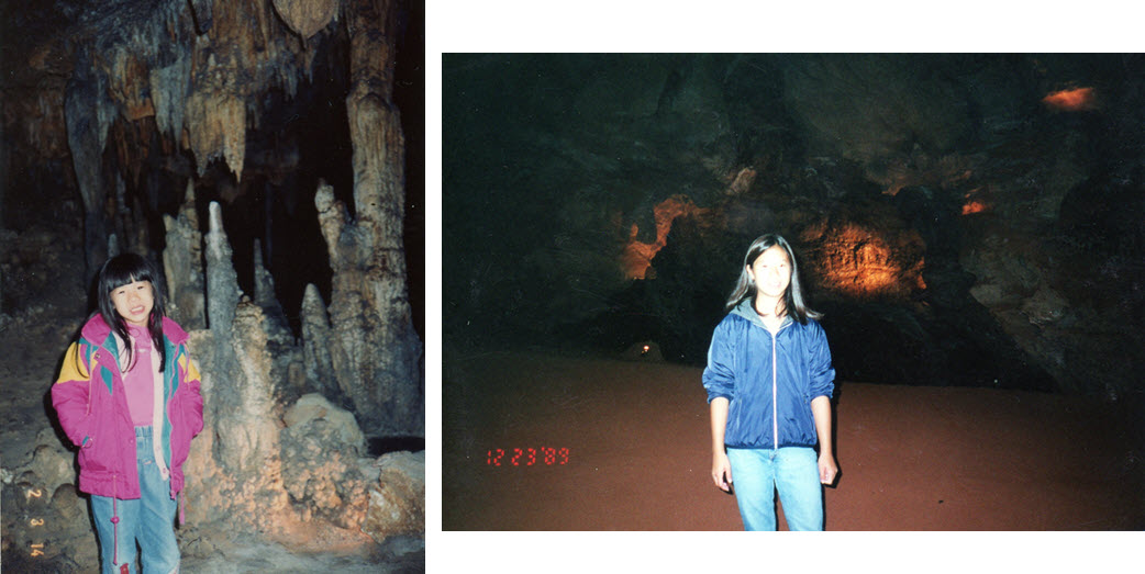
I’m recalling at least 3-5 visits to the Luray Caverns with family visiting overseas. Based on their website, this attraction has the largest caverns in the eastern US and they are now step-free! That’s amazing they have made it super accessible for all. I found some old photos when we visited – you can’t see much so you got to visit in person!
There are other attractions in southern VA, such as, amusement parks and the Amish community. I don’t know the name of it but I know I’ve been a few times when family from out of country visits us!