
We flew across the states to Salt Lake City on Southwest airlines and enjoyed some drinks with the drink coupons! We rented a car for 2 weeks and started our drive east to Roosevelt for the night. I had rented Airbnb throughout the trip, staying 1-3 nights depending on the location and itinerary. We stopped for dinner at Rubio’s for Mexican food to celebrate Cinco de Mayo and drove through the darkness to our first Airbnb (motel room, that was not staffed, but it was clean and we crashed for the night).

Tips
- Recommend not using the sky captain check in at the curbside, they expect a tip so just check in yourself inside the airport
- Plan your meals, route, and stock up on water from Walmart
I misread the Airbnb offering breakfast, there was just a vending machine on site so we ate some of our packed jerky and got to the Dinosaur NM (UT-side) in a few hours. We took a tram up to the quarry – a whole wall of fossils.
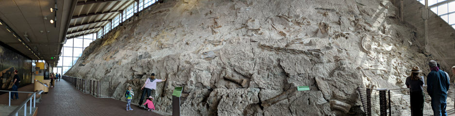
We learned about how the quarry was created, rebuilt and bones were excavated to be on displays around the US, several at the Smithsonian. We took a short walk back down to the car via Fossil Discovery Trail, instead of waiting for the tram. I started to collect stamps and brochures on this trip, but forgot to grab one at this first site 🙁

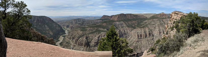
We lunched at a local highway bar & grille, which seemed to be a popular motorcycle pit stop. The owner (cook) carried a gun at his waist, but he made a delicious grilled cheese. We then drove 31-mile scenic road of the Dinosaur NM (CO-side) to hike Harper Corner trail. At 2,500 ft of elevation from the river below, the trail was short (1-mile in and out). There was a pretty steep drop off on the trail (see below) and then a gorgeous 360 view at the end (with a fence).
We then made our trek back to Utah, toward Moab (3 hr drive) for a few nights. We originally booked at an older hotel in town to save money but then decided to splurge on a newer tiny house rental (Grand View Cottages) further away from the main street. The host manages 6 of them so you can pick one that fits your needs.

Tips
- Consider housing options: do you need a kitchen to make food? Do you want to be walking distances from the stores/restaurants? Do you want free parking and other amenities?
- Check the forecast and plan out the next days in Moab: what do you want to do? see? eat?
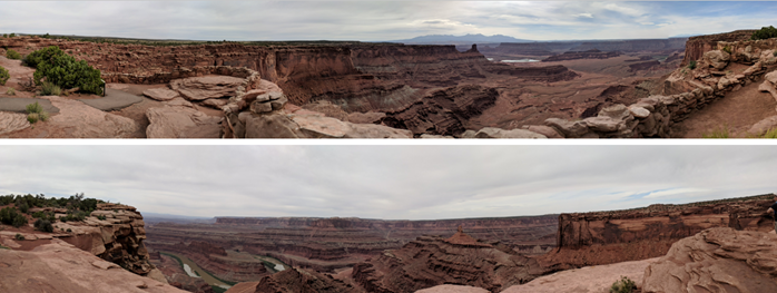
Since we booked a timed tour for Day #3, we decided to visit the Dead Horse Point State Park ($15/car at the time, now it’s more) near Canyonlands NP. It was named after a cowboy, rounding up horses and it dead-end at dead horse point. It was also a film site for Westworld season 1, but we couldn’t get into that TV series. We saw a horseshoe bend (many on this trip) and walked along the edge of the trail. Although it was cloudy, it was still warm during May.

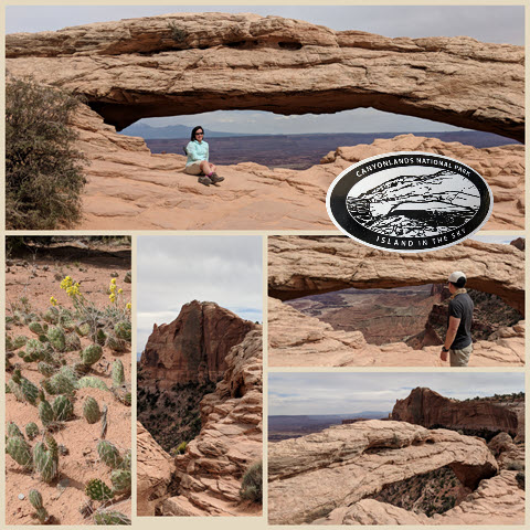
At 20 miles west, we visited Canyonlands VC, Island in the sky district (pretty much spent 2 hours there). It was much busier with lots of mountain cyclists/bike trails. Moab is a very popular place for cyclists in the nation.


We hiked the Grand View trail (<2 miles) to the point to view 360 degrees of the canyonland floor. We watched from above of cars traveling the canyonland below – it reminded me of the movie/novel series, Maze Runner. Then ,we ate and rested at the point before stopping by the Upheaval Dome Overlooks. Such amazing views and lots of people around.

Our last stop was the Mesa Arch (0.5 mile loop), which we purchased a panoramic sunrise poster of it and stamped the date we visited in one corner. Although I messed up the stamp in one of the corners, I covered it with a sticker later.
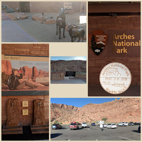
We rushed over to Aches NP to pick up our Fiery Furnace permit before they closed (and saw some junior park rangers getting sworn in). I didn’t account for the time spent just getting through the gates. If everyone had bought a park pass, it would be quicker to get through. They really should have a line for passholders and another for cash/credit. We spent 20 minutes in line – even caught ourselves on the live camera feed posted on their website (see in the red circle below)! We had an early dinner and rested up in preparation for the Fiery Furnace tour in the morning.

We got into Arches NP early and explored the Balanced Rock and Windows area. I see their website now implements a timed entry reservation, thus hopefully reducing the time you spent waiting in line to get through the gates.

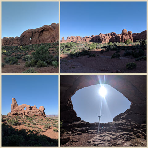
Then we joined our ranger, Juliet, on the 3-hr Fiery Furnace tour ($16/pp) at the viewpoint around 930a. You could explore by yourself but you still need a permit ($10/pp) and people can easily get lost, so we decided to join this tour of 14 persons.
It was a different kind of rock scrambling and squeezing through narrow paths. I enjoyed the tour and thankful for the cool shades between the canyons. If you step outside, it was super hot and sunny (no clouds in the sky). We rested under a hidden arch, which just appeared out of no where as we wandered the labyrinth of sandstone walls. I highly recommend this area if you have time.
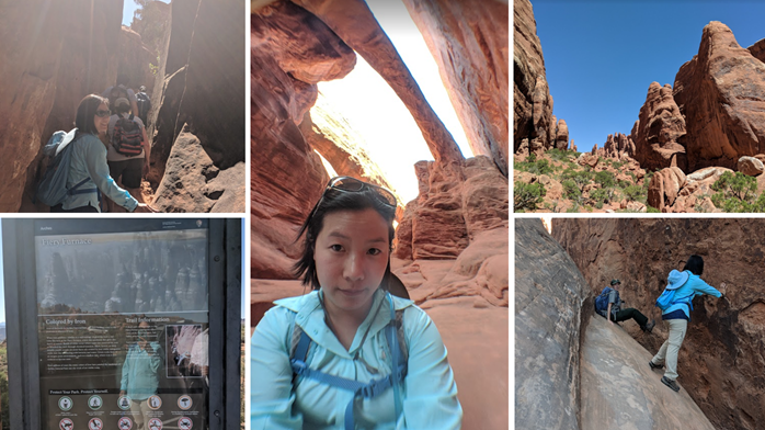
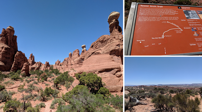
After the tour, we took a drive around Devil’s Garden but it looked busy so we decided to take drive an unpaved road for 8 miles to lunch at Tower Arch. We hiked 2.6 (RT) miles in sand/rocky trail but it was worth the peace and quiet, as we rested under the arch. There were only 1-2 other folks around this trail.
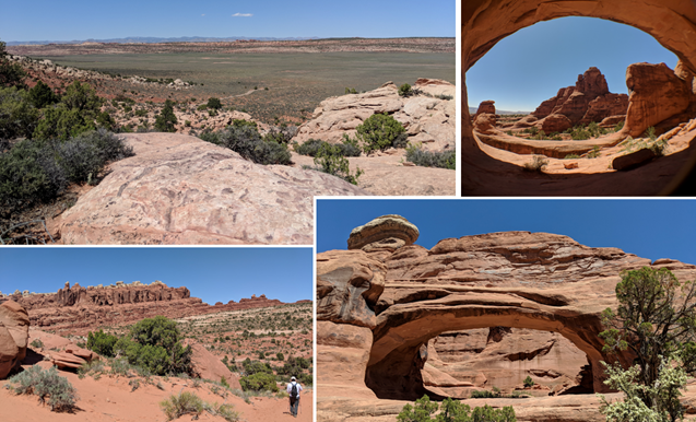
Back at the car, I was thankful for the hiking poles to get me through the sand and heat, my shins were aching but tolerable. We were too tired to do another hike. We saw the Delicate Arch (the most famous) from the lower viewpoint below. It looked so tiny! I zoomed in as much as I can, and those specks are people standing by the Delicate Arch 🙂

We went back to the Airbnb and made some bison meat pasta for dinner. We decided to visit the Arches NP around 9 pm to stargaze and catch the Milky Way. It was pretty dark without the car lights, but no Milky Way since we were too early. Apparently it comes out later in the night and we are usually sleeping already.
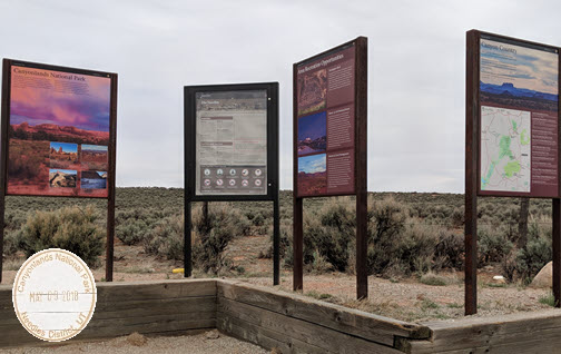
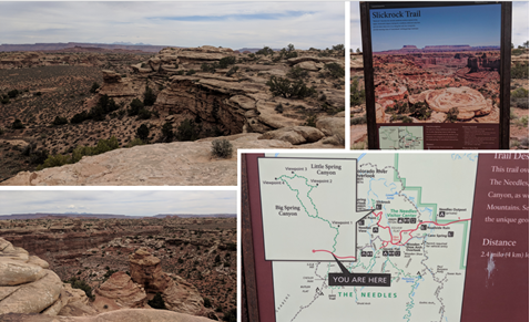
We dedicated the day to visit the other district of Canyonlands NP, Needles! It was 75 miles south of Moab, which was a 1.25 hours drive. It was definitely less popular and more wilderness. The views were unbelievable, no picture or video could replicate seeing it in person. But, I’ll share some of the unique sites I enjoyed.
We kept an eye out for the bighorn sheep but no sighting as we took a walk around Slickrock trail. I jumped across a gap to a rock and got nervous if I didn’t make it and fell in between the rocks. So, I ended up scrapping up my palms when I landed on the other side.
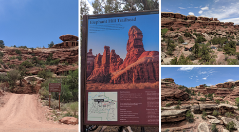
Later we lunched at Elephant Hills where folks can drive off road in their 4×4 cars up and down big hills.
Our rental car made it through another unpaved road and we stopped by an old cowboy camp site, spring and rock paintings (Cave Spring trail, 0.6 mile loop) which was okay – although we had to go up two wooden ladders to see the surrounding terrain. We also stopped by the Roadside Ruin trail (0.3 mile loop) where you pass a small structure tucked beneath a ledge about a dry wash.
On the way out of Canyonlands NP, we stopped by the Newspaper Rock (~2,000 year old petroglyphs on rock) – which tells a story but much is left for individual interpretation.

At night, I was still in school so I had to finish up an online exam for the semester. It was so nice to be done though. The Dead Horse State park was designated as Dark Sky but it was too far to drive in the late night to see the Milky Way.
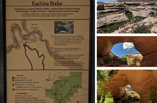
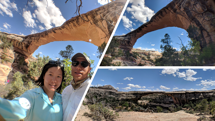
We left Moab for good and drove 2 hours to the Natural Bridges NM. We drove the one-way 8.6 mile loop around the area and stopped at each of the three bridges for a lil hike to see it up close.
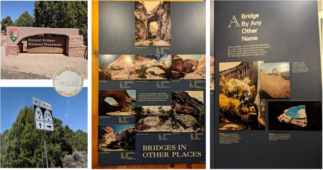
Sipapu (2nd largest in the US), moderate hike (1.2 mile RT) that included several stairs and ladders. Quite windy at one of the stairs so you can see my holding my hat from flying away. We met an older lone hiker with his big camera going for a stroll on the trail.
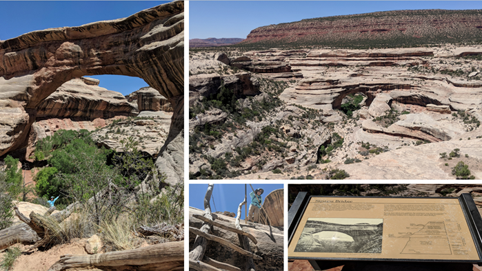
Kachina, less moderate but still strenuous 1.4 mile RT hike, this was a massive and young bridge in the park.
Owachomo, “rock mound” in Hopi, this was a short accessible 0.5 mile RT trail to see the thinnest (oldest) bridge in the park.
We continued south and saw Bears Ears NM (President Obama’s dedicated monument in 2016) from the rear view window on the way to Mexican Hat. We stopped to take a quick picture but didn’t have time to visit.
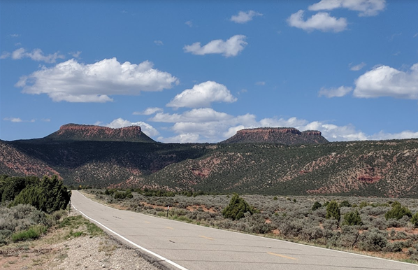
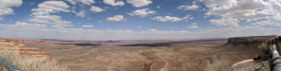
I also unintentionally planned this route and didn’t realized we needed to descend down the Moki Dugway. It consists of 11% grade, switchback dirt roads.
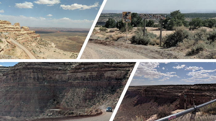
From the top, we could see the Valley of the Gods stretching wide and spotted a few cars on the 17-mile dirt/gravel off-road through it.
As we made our way slowly down the road in the rental car, there were some pretty tense moments around the bends. The car has endured a lot more than a typical road car on this trip! We finally got to the bottom and saw the colorful Navajo rug design decorated the mountain sides as we passed by. We stopped to take pictures of the Mexican Hat formation before heading to Monument Valley.

We also stopped to take pictures on Hwy 163S to capture the famous Forrest Gump scene where he had run for miles and decided to stop and turn around. It was pretty windy so I kept holding my hair still, but I got a couple shots in the middle of the road when there were no cars nearby. We weren’t the only ones standing in the road, but you can easily see if cars were coming close.

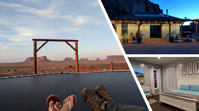
We checked into our Airbnb which was a solar power house, so we left the windows open to cool down the bedroom. The owner was tending to the grounds, and there were goats walking about! We stopped by a small grocery store, and checked out the Goulding’s Monument Valley Museum featuring famous film locations, e.g. Back to the Future III, Forrest Gump (these were the two that I recognized).

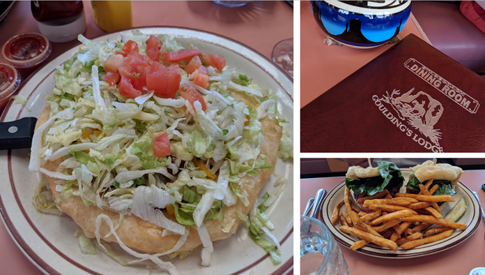
At the Goulding’s lodge/dining room down the street, we ordered “frybread” (Navajo style fried bread) mini taco and burgers with fries. We walked through a gift shop afterwards but didn’t buy anything.
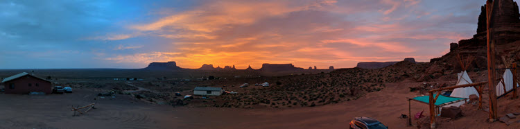
We finished the last of our local Apricot beer on the Airbnb’s trampoline and watched the sunset with bats flying around. It sure was a great view! We weren’t used to sleeping with open windows and seeing spiders on the way to the bathroom, but we got some shut eye because we were exhausted from driving all day.
We woke up to a cloudy sunrise through the window but it was still beatiful! We got ready for the Wildcat Trail (3.8 mile RT) at Monument Valley Navajo Tribal Park, there was an entry fee of $20/day pass (now its $8/per person). We walked around the valley and saw so many buttes. The wind was a little rough so we covered up with our buffs.


You can also drive on an 13-mile unpaved road around the valley or take a tour, we opted out of this as we didn’t want to push the rental car and we wanted to get to our next destination early. There was a visitor center/gift shop that I created a penny souvenir (used to be 50 cent but now its $1 to process). We also found out we were close to the Four Corners Monument (were 4 states: AZ, CO, UT, NM met together) but it was the opposite direction than our next destination. We will add it to our Colorado trip in the future!
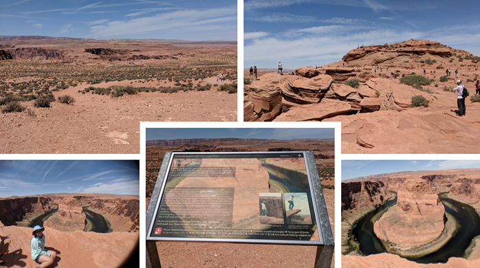
We continued to Page, Arizona to stay for the next few days. Since we got there early and couldn’t check in our Airbnb yet, we stopped by the famous Horseshoe Bend for free. Now, they charge for parking, $10/car, but it looks like they expanded the parking lot in 2019 and made the path even more ADA friendly. There were many tourist buses and people all over the cliff, taking pictures. It’s a short 1.25 mile RT walk but it was a steady incline back up to the parking lot (did I mention it was hot so it made the walk back pretty hard?). It was very green and not as pretty as I’ve seen in advertisements, but we were there!
After we checked in and did some laundry in the Airbnb, we decided to stay in at night instead of going back to the Horseshoe Bend for the sunset pictures. I can’t imagine how busy it would have been.
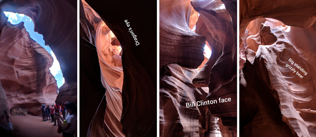
I was very excited about this tour and you will not be disappointed when you go!! (Note: you will have to climb up/down stairs during the tour). In the morning, we got ready for our booked Lower Antelope Canyon Tour at 915 am ($48/pp) and now it’s increased to $55 in 2023. Be mindful since the pandemic, they still require masks so make sure you read all the info and get there early. As we waited for our tour to start, a Navajo dance show was happening and then we followed our guide, Kendrick, down stairs to the floor of the canyon.
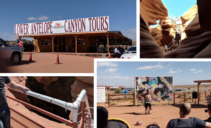
The whole time we were just looking up at all the colorful formations with wide-opened mouths and craned necks. It took an hour to walk through with lots of picture opportunities.
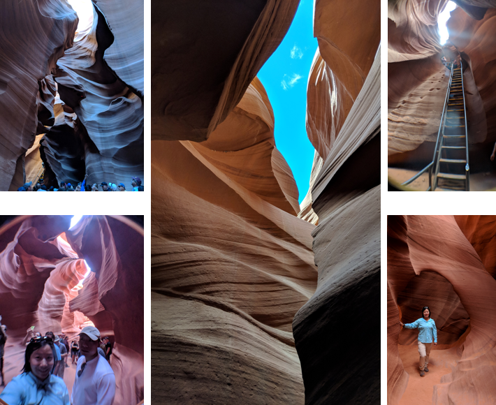
Our guide helped with camera filters and took pictures for us as well. We got cold water at the end of tour and it seemed common practice that everyone gave him a tip. (There were just too many pictures to post so here are some to inspire you to visit one day!)
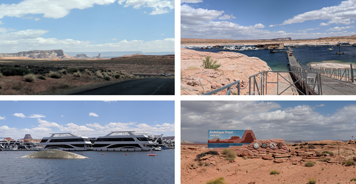
The rest of the day was free-time to explore so we checked out the Antelope Point Marina and visitor center. The water was so clear blue from Lake Powell – there was guy fishing and we watched him a bit. Then we ate lunch back at Airbnb and rested inside as the temperature got warmer.
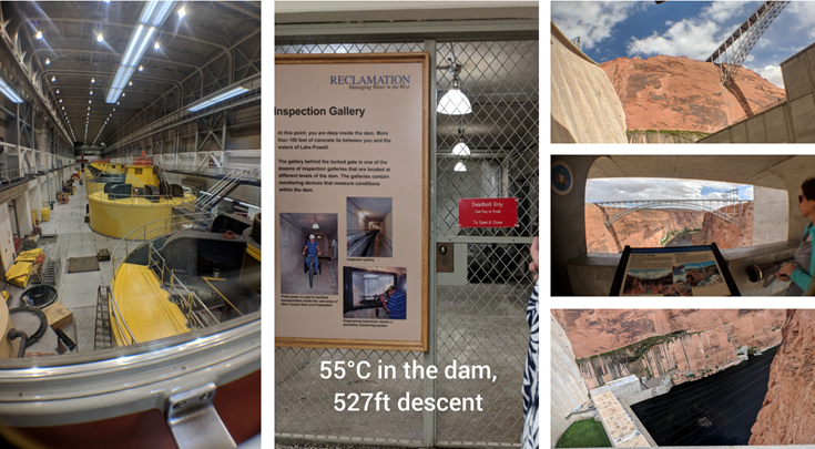
We decided to swing by the Glen Canyon Dam (2nd highest concrete-arch next to Hoover Dam). We visited the Visitor Center for stamp and learned about the dam history.
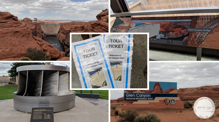
We were waiting to see if people were no shows so we could join the last guided 45-min tour at 330 pm ($5/pp) to visit the bottom of the dam. Luckily, we had this unique experience on the tour, since we didn’t spend much time when we saw Hoover Dam for a few minutes years ago. First we took an elevator to be able to walk on the crest of the dam, then we took another elevator to the bottom of the dam.
We decided to check out a short 1-mile loop by Lake Powell, called the Hanging Garden. The views all around was gorgeous. I later learned about the Rainbow Bridge NM, but it was either a 16-17 mile hike or accessible by boat/tour and a 3-mile hike. The water levels gotten very low over the last years so access is limited.
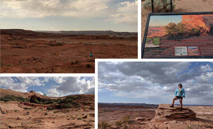
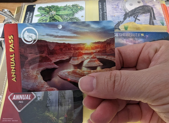
We loved the one of the NPS card design and realized it’s at Lake Powell. We would like to come back to visit the Reflection Canyon but it is a challenging 20-mile RT adventure. Most people backpack but we are day hikers so it may not happen. One can always hope to return back to this amazing area! Below I’ve started to collect the national park passes over the years.
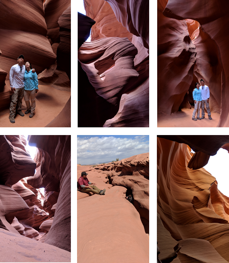
We checked out the Airbnb and joined the Upper Antelope Tour (Antelope Slot Canyon) at 1030 am. It was more expensive than the Lower Antelope tour ($60/pp when we went, and now its $102-standard or $120-prime time which includes 1020 am) since this includes a truck ride to the site.
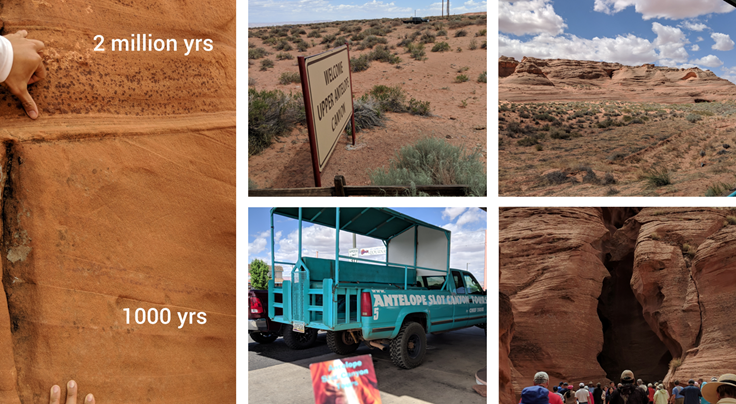
Be prepared as the truck ride was dusty and bumpy, as we sat on bench in back of truck. Once we parked, our tour guide, Ernest, told stories and took us through the canyons. These rocks are old (dating back to 2 million years ago)!! The walk was in and out so it was a bit more crowded and there was a “photography” tour ahead of us so they get more time to set up and take pictures (see some of the sites below). In my opinion, the lower antelope was more unique, so if you’re only here for a day, definitely book the lower tour instead!

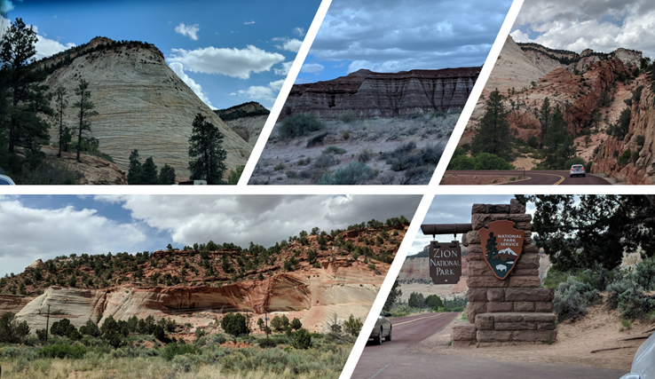
We grabbed some groceries on our way to our next Airbnb cabin outside of Zion NP. Before we checked in, I was getting requests from the host that he would credit us if we could “clean” after our stay since his cleaning crew wouldn’t be able to get there. But the previous renter did not clean so there were hair everywhere, unmade bed, the water was cold and toilet pressure was slow since this was truly a rustic cabin in the middle of the mountain. It was not what I had in mind when I booked and it was not worth saving money to stay in a place that wasn’t what I expected.
Luckily there was vacancy at the Zion Ponderosa Ranch Resort, just down the street after we scarfed down a quick dinner at the rustic cabin and returned the key. I used the resort’s Wi-Fi to contact Airbnb customer care to cancel the booking and got all our money back. We then booked a cabin suite (forgot to take pictures of the outside) and unloaded our stuff.
We drove the 17 miles to the Zion Canyon Overlook (short 500 ft trail), but it was getting cloudy and sun was setting soon. The rock formations were still so vibrant and colorful, I could look at the view for days!
Finally we encountered some bighorn sheep walking on the side of the mountain side so we pulled over on the road like others to watch them walk by in the sunset. They really do blend in and you have to zoom to see them 🙂
Then, we enjoyed a clean shower that night after I pushed the rustic cabin encounter out of my mind. The bedroom had a queen bunk-bed so we had to slide into bed and careful not to bump our heads sitting up. At least we had hot water, Wi-Fi and TV for the next 3 days.
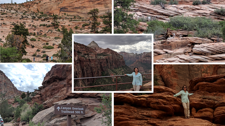
We ate a continental breakfast, included with the resort stay and drove up the mountain 3 miles on a dirt road to the East Mesa Trailhead. This trail eventually takes us to the Observation Point at 6,508 ft elevation (6.4 mile RT) – there were wild flowers on the dirt path. It was uneventful and long, but when we got to the point, it was breathtaking. You can access it from Zion NP and hike up the strenuous 8 mile RT East Rim trail (but it’s currently closed due to rockfall in 2019) – #7 Weeping rock bus stop.

We rested and took pictures at the point. There was a ranger who let me take a picture of a feather from the California condor, it was as long as my arm! There were many chipmunks running around the rocks around us. We could also see Angel’s Landing and the transportation through the valley below.

After getting back to the car, we drove down to the Human History Museum and Zion visitor center. There were so many cars illegally parking as the lot was full but we waited for a spot. Lots of people were getting their permits for the Narrows but we didn’t plan on getting wet. I got my stamps and park map to review back at the cabin. We did spot some more bighorn on the drive home!

We started early in the morning and parked by Canyon Junction to hop on the shuttle ride up to stop #9: Temple of Sinawava. You can walk along the river until it ends and where the Narrows trail begins. There were plenty of people who had rented water shoes and staff to walk with. We would like to try in future but I’m still not keen on being in water so it’s not high on my list!
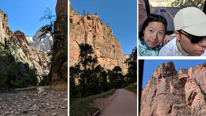
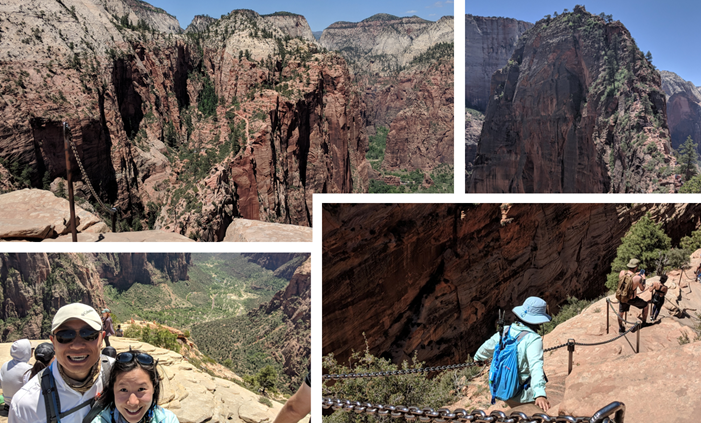
We took the shuttle back down to stop #6 The Grotto for the Angel’s Landing – now requires a permit via lottery system as of April 2022. This is where the West Rim trail began and slowly worked our way up to Scout’s lookout (2.4 miles), includes an steep incline with switchbacks. The sun beamed and made my heart beat fast. We finally made it up the Walter’s Wiggles (21 switchbacks) and lunched at Scout’s Lookout.
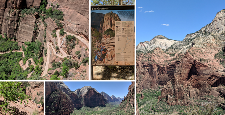
There were so many other folks all over the top and I had not planned to go on Angel’s Landing but I reluctantly followed my other half up the chains/guard rails up the top of the mountain. There were some points where you look down steep drops to the left and right! So I kept looking forward until we got to the end and had a 360-degree view of the Zion NP. I’m glad I did but I was still scared at some parts when we returned to Scout’s Lookout.
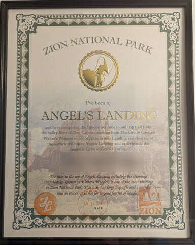
We returned to the Visitor center to grab the Angels’ Landing certificate and stamped it to be framed with pictures.
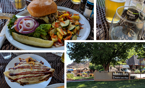
We drove south to Springdale (outside of the NP) to have dinner at Meme’s Cafe. Enjoyed a sweet celebratory drink for making it to Angel’s Landing, along with some BBQ crepe and mushroom swiss burger on the patio. What a nice evening and then returned to our cabin to crash.
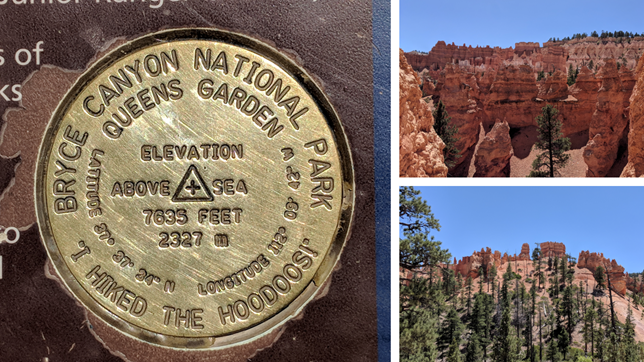
We went to the 4th of the big 5 Utah parks, Bryce Canyon! Along the way, we passed through the Red Canyons Tunnel Road but it was under construction so we drove around it. Once we got to Bryce Canyon, we started down the Sunset Point and saw Thor’s Hammer. It was a fun switchback trail down, but my legs were so sore already. The views were so unique and breathtaking.
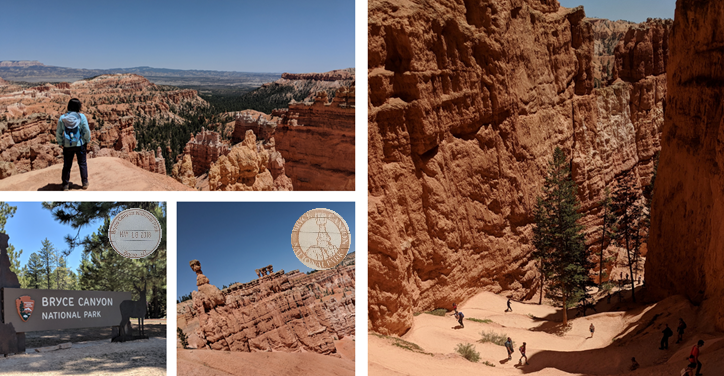
At the bottom of the trail, we lunched under a shade and watched a chipmunk do a mating call and twitched his tail. The Wall Street trail was closed for renovation. We went to Queen Victoria garden instead and passed through many tunnels as we ascended up to the sunrise point. There was a spotting of “ET” on the trail.
There were big tourist buses so we try to avoid them. We took the car and drove to the end of the park to see various overlooks, they were all amazing but no time for another trail.

We stopped by Red Canyon VC (Dixie National Forest) for a stamp and I took a picture with Smokey Bear statue. Then, we checked in our Airbnb yurt! Her driveway was all gravel so our rental car took a beating getting up there. We then went out for dinner (homemade pizza) in the nearby small town, Panguitch. Did some laundry in the yurt at night, and tried to see the Milky Way at 3 am since her yurt is in the middle of nowhere. But, it was a little blurry in the night skies and probably also we were drowsy from sleep. You could hear the car driving by very loudly as there’s nothing to echo off for miles so we didn’t sleep very well that night.

We continued our journey early in the morning, stopping by Grand Staircase-Escalante VC and was recommended this unique hike (Willis Creek Slot Canyon) in the area. It was our last off-road adventure through a sketchy dirt road (6 mile to trailhead). We hiked through 4 sections (4.8 mile RT) and turned around at this big boulder. We stopped to snack and returned to the car. A handful of others were exploring but we were mostly alone.


We drove the rest of the scenic byway 12 drive and grabbed Subway to enjoy at Capitol Reef NP (no fee station; honor system). It was the least populated and remote park of the big 5 in Utah.
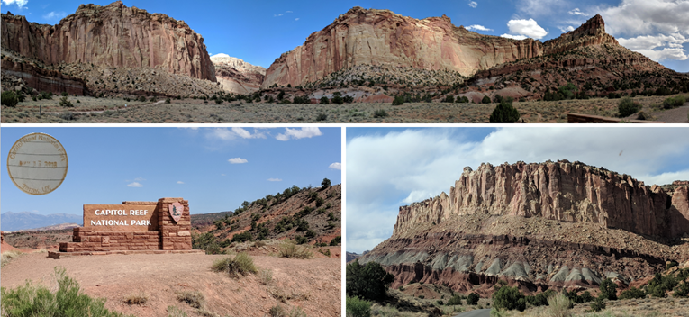
We ate our subs at the end of the park, but skipped driving dirt roads to get to the trailheads. We took in the scenery and then drove to Panorama point to get a view of the amazing rock formation.
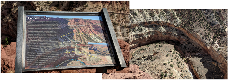
We also stopped by Goosenecks point (short trail) to see the Kaibab limestone in Capitol Reef’s lowest layers (which makes up the top layer of the Grand Canyon). We hope to return to Arizona again soon to hike the Grand Canyon.
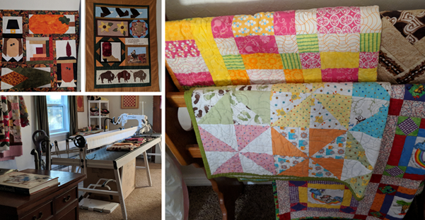
We checked in early in our Airbnb rental, which was a studio above the host’s garage. They let us in and showed us the rental. The studio is also the host’s hobby space for all her quilting. She had lots of beautiful projects laying around. We settled in and watched some tv for the rest of the night. As we didn’t want to bother them going back out through their garage (wasn’t sure the logistics of that).
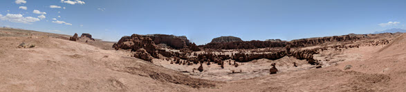
Our last full day in Utah, we made our way north, seeing Mars-like terrain and I’m pretty sure NASA trains out there. We finally made it to Goblin Valley State Park and paid $15 entrance fee. You can also apply for a permit ($10) via form online beforehand.
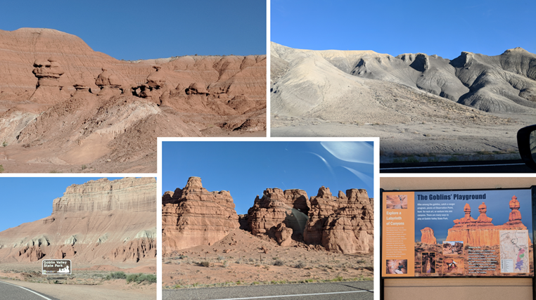
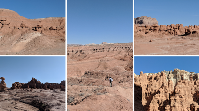
We wanted to find the Goblin’s Lair but we missed the sign from the beginning so we were very off course, as we climbed a few steep hills and poked at other “caves”. We were running out of time to find the lair as I only allotted a few hours here but we finally found it when we met another couple who pointed us in the right direction. It was the best ending/hike for our Utah trip!
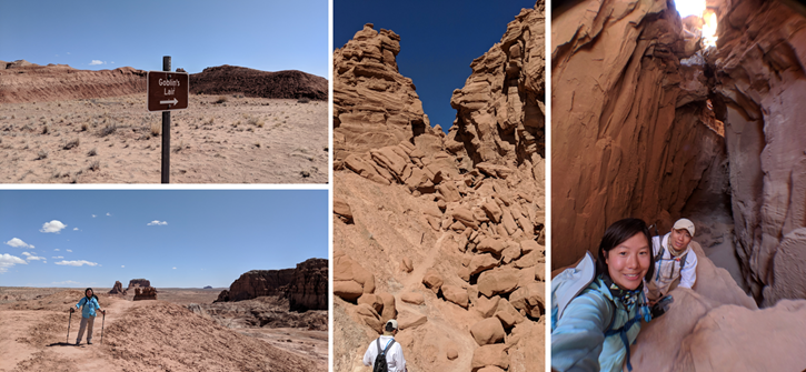
We traced our way back by following signs to the entrance and glad we finished when we saw a school bus of students starting their field trip.
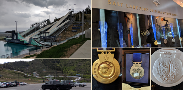
At least we saw the lair before we had to leave and head back to Salt Lake City aka SLC (3.5-4hr drive away). The weather went from 80’s to 60’s with rain storms. We stopped by a McDonald’s and ordered our lunch via a kiosk, that must be new! We checked out Olympic Park as we missed the guided tour around the area so we checked out the Alf Engen Ski Museum and SLC Olympic Museum instead. We drove through Park City but it’s off season so it was dead. It also had all kinds of tourist traps so we left after getting a few souvenirs.


We checked in our last Airbnb in downtown Salt Lake City (SLC) and walked over to Crown Burgers for dinner. This is a local fast food chain in this region, that serves quality burgers in decorative restaurants. We walked through the Temple Square church on the way back to turn in for the night.

We woke up early and checked out of Airbnb. Grabbed some breakfast at Eva’s bakery on the way to the car rental. We thought we were late but our flight ended up being a Utah Honor Flight so all the veterans were seated first, I’ve never seen so many wheelchairs at the gate!

Our seats was the last row in the airplane, but we got some free donut holes when the Utah Honor Flight staff passed it out to everyone on the flight. We also got a free drink on the house so we gave our drink vouchers to our friends to use later.
When we landed, they all sang “God bless America” and the firetruck sprayed a water salute as we pulled up to the gate. With this delay, we also had to wait for our luggage and finally made it home. It was so nice to sleep in our bedroom again. Here are just a few souvenirs I bought for myself and to give as gifts. This is also my last shot glass I would buy since I also gave away my collection since I was running out of room and we don’t ever use that many nowadays.
Note: My first Starbucks Been There series mug from the state of Utah. Honestly, I got it because I had a Starbucks gift card I wanted to use up and I don’t drink coffee so I decided to use it as a reusable souvenir at home. I’ve since collected a mug from Maryland, Maine and my friend got me California. But, there’s no way or space to get one from each state!!
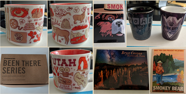
Reminder to self: Don’t buy anymore magnets (fridge wall was getting filled up) and postcards (unless sending them to friends). Perhaps, stick with buying stickers from now on (doesn’t take up much space, not too pricey and it’s a fun collection to put on my notebooks).
